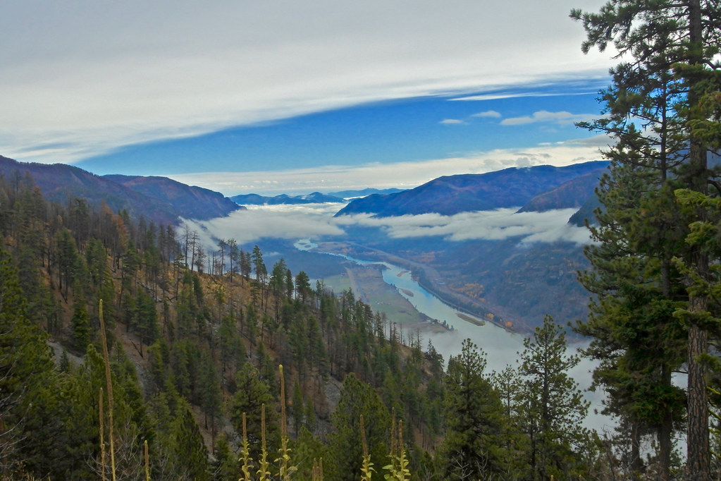
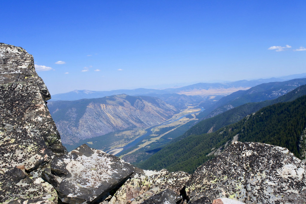
The KooKooSint trail (USFS trail 445) starts about a mile north of the junction of the Thompson River road and Montana Highway 200 and makes its way up to the top of the western end of KooKooSint Ridge. In about two miles of hiking through eleven switchbacks on the primitive, rocky and rugged foot trail you climb about 2,000 feet to the ridge top from which this photo was taken looking to the east over the Clark Fork of the Columbia River. Somewhere near this point was where the Copper King fire started this past summer.
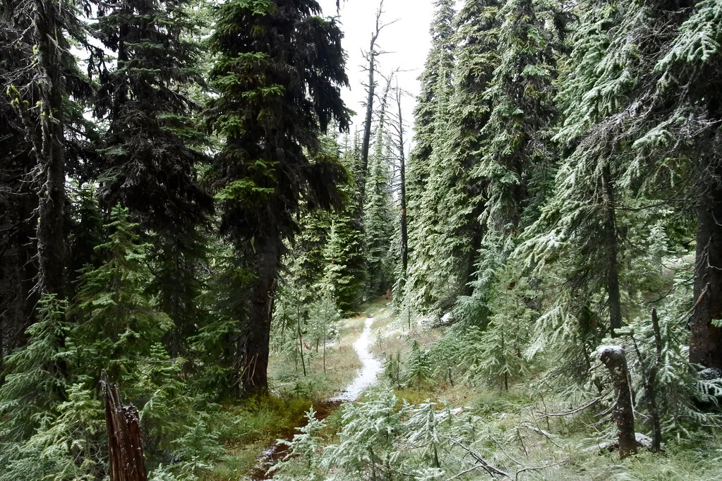
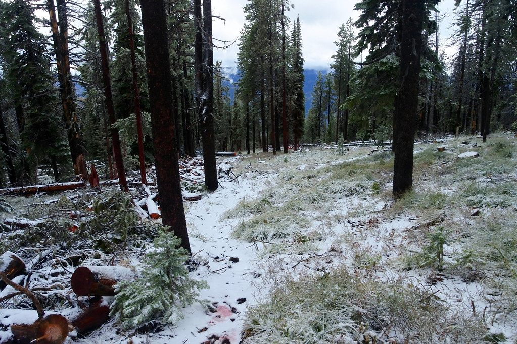
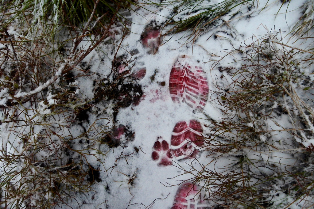
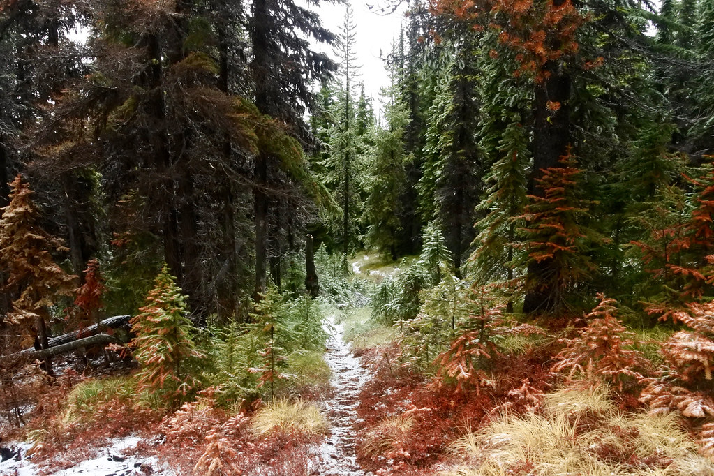
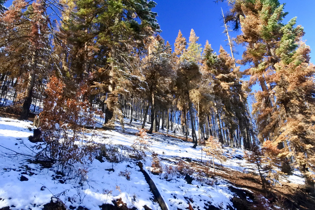
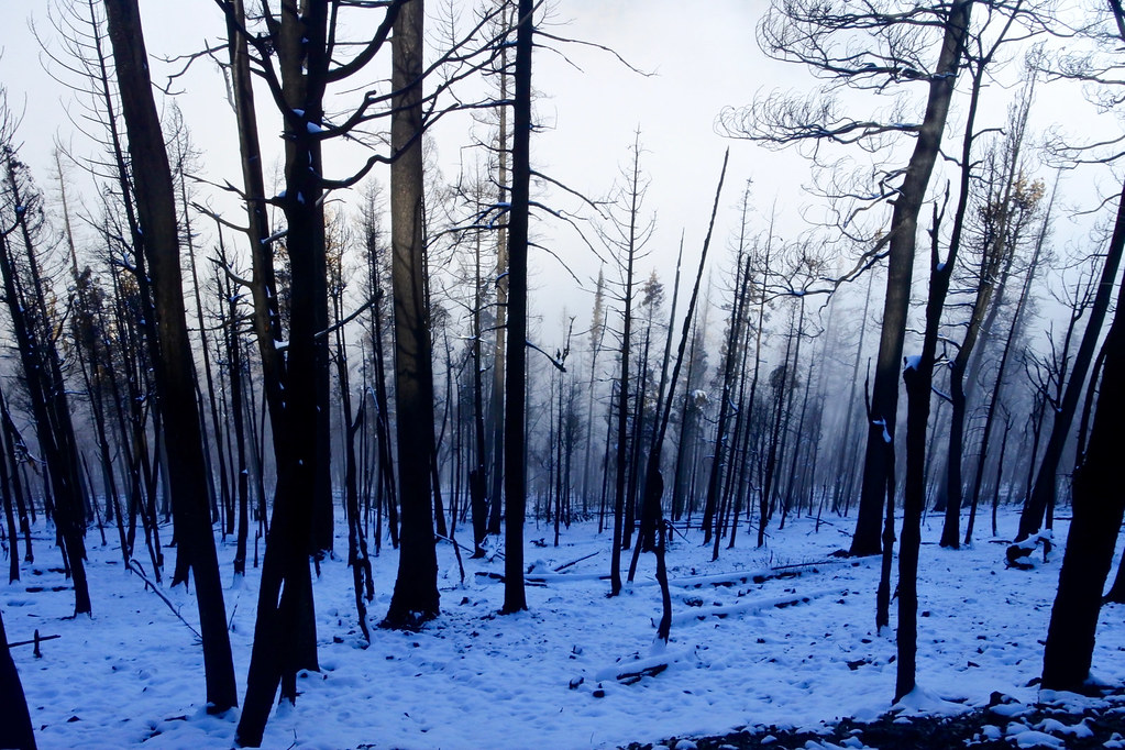
After leaving the Big Hole Lookout, we hiked due west on the Bay State Creek trail (USFS trail 1268). The first two photos were taken of the trail in the first mile west of the lookout through what is still virgin timber that remains after the fire. The third was perhaps another half mile just before encountering the burn area of the fire where it crossed the ridge on its way north. There must have been a lot of retardant dropped along that edge of the fire, first noticeable when I saw my boot tracks turn red as they pressed the snow down into some of the remaining retardant.
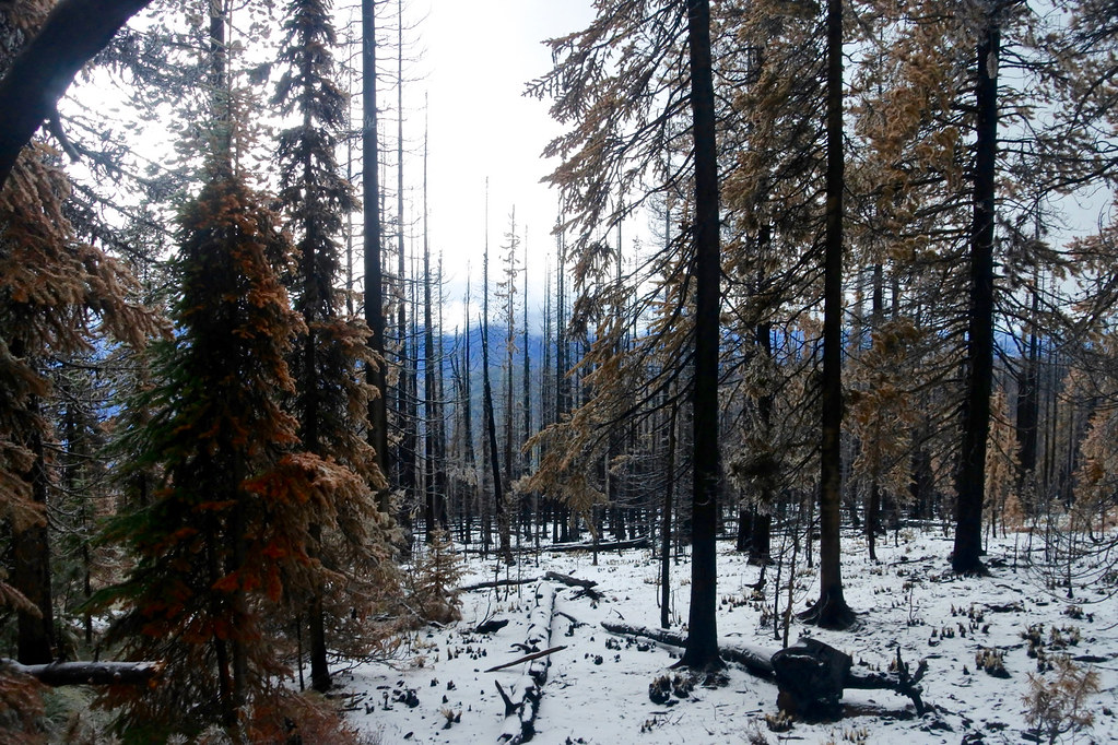
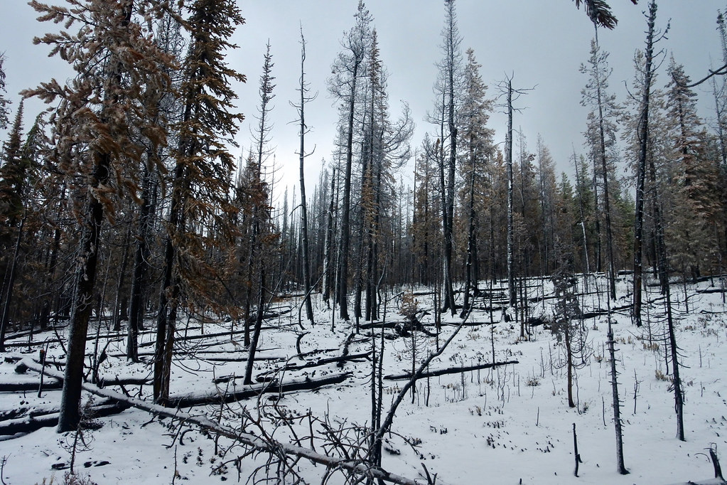
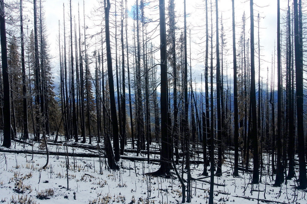
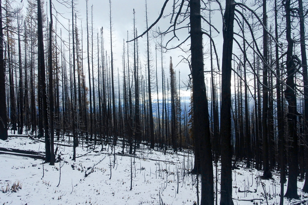
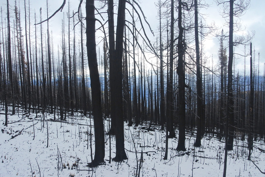
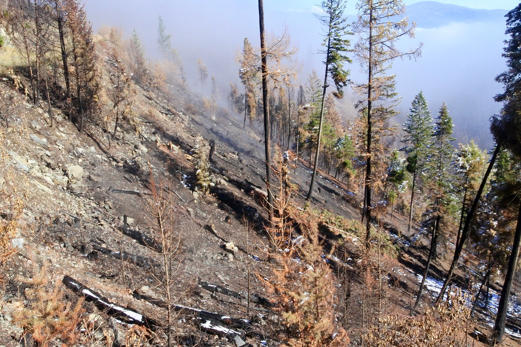
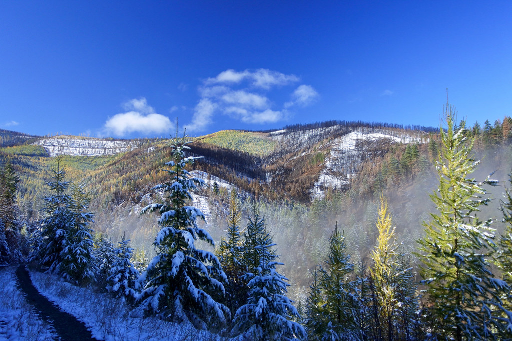
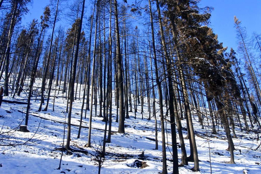
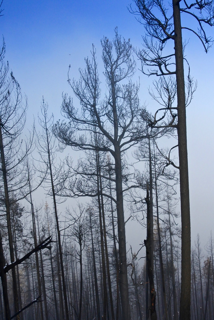
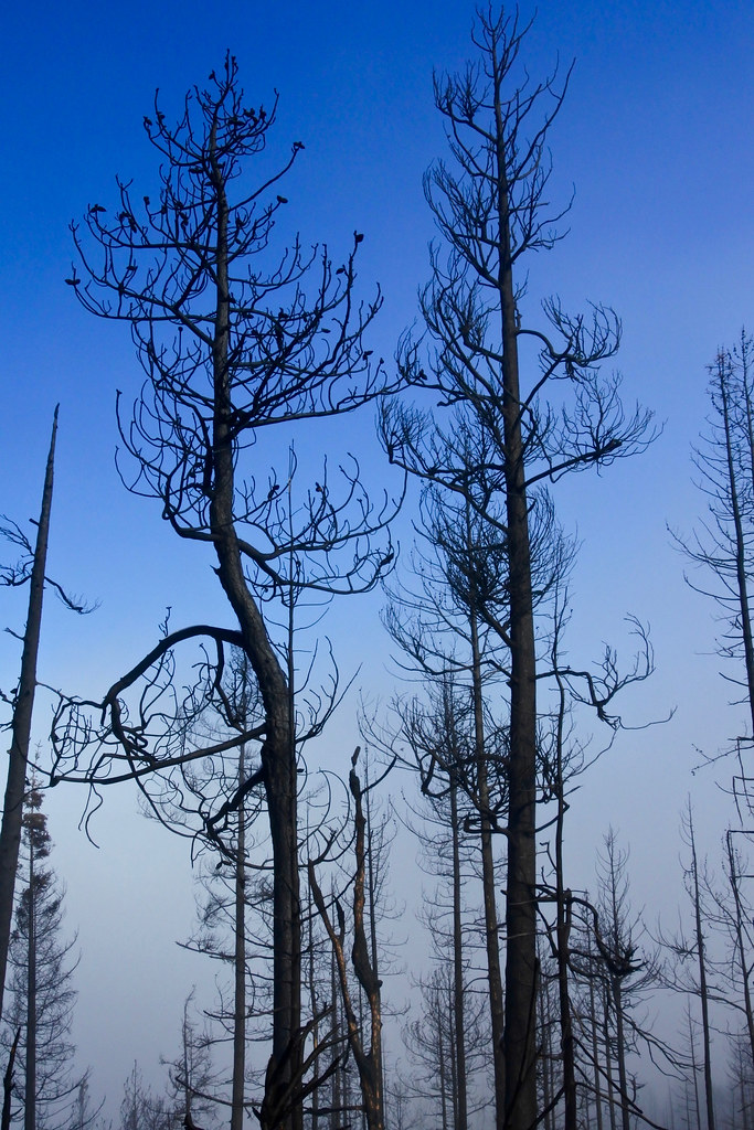
On one of the days in the early part of the fire the weather produced a very strong south wind that pushed the fire to the north across the ridge. Before seeing the area I had thought that we would encounter a huge burned area extending far to the west. Instead, there was a swath of no more than about a quarter of a mile wide that must have looked like a huge blow torch when he fire burned through. That wind may well have saved the lookout and a lot of devastation to the east of it because it must have pushed the fire through that swath so fast that it burned practically nothing on either side until it went over the ridge, sparing the forest on either side. The transition from untouched forest to completely burned timber was an area of only perhaps 30 yards. The next 7 photos were taken within that area.
I took many more pictures as we walked through the burn, but they all looked the same. One last step in the severe part of the burn, then about ten more and suddenly we were in completely untouched timber again. The last two photos show the short transition from the burned area back to virgin forest to the west of it. At that point we had just enough time remaining to hike back to the trail head before dark. I still hope to be able to make one more trip up there before the deep snow comes just to hike a couple more miles to the west and see what the fire may have done that far west.
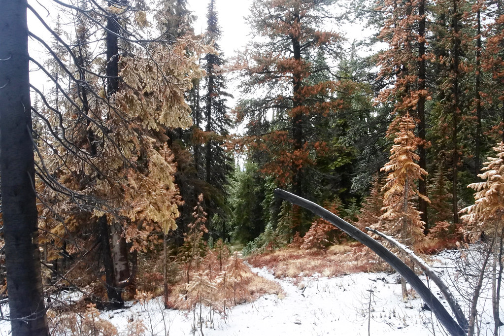
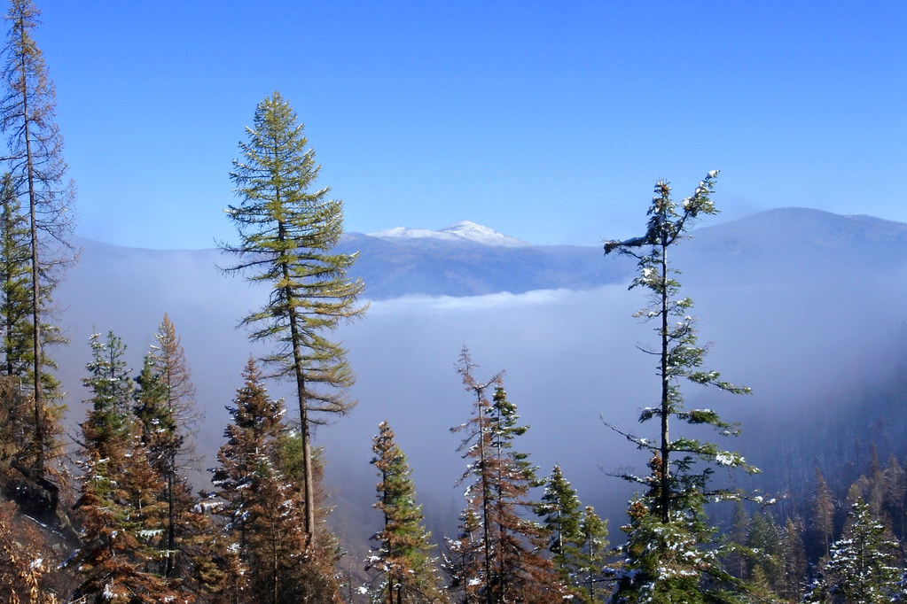
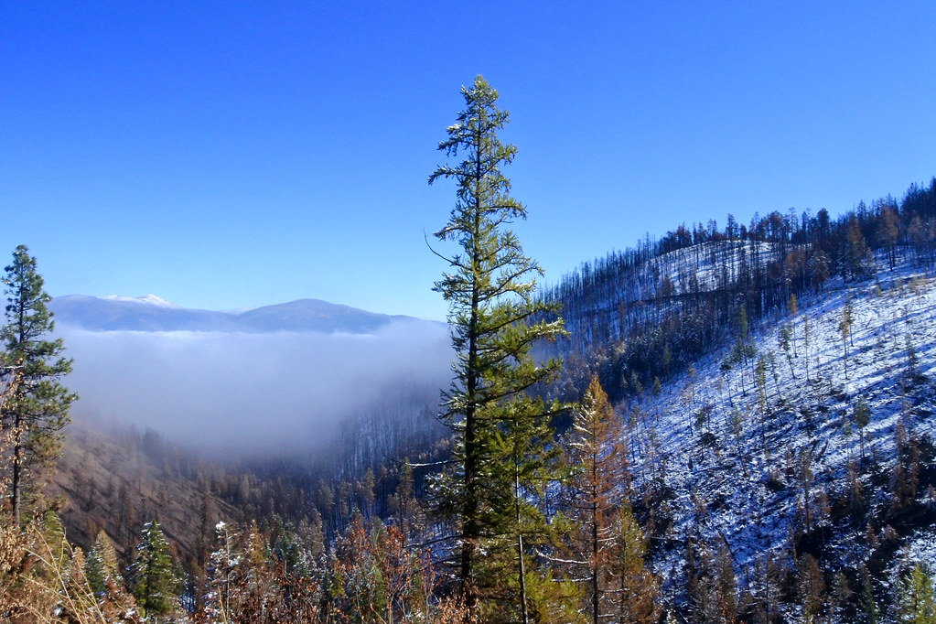
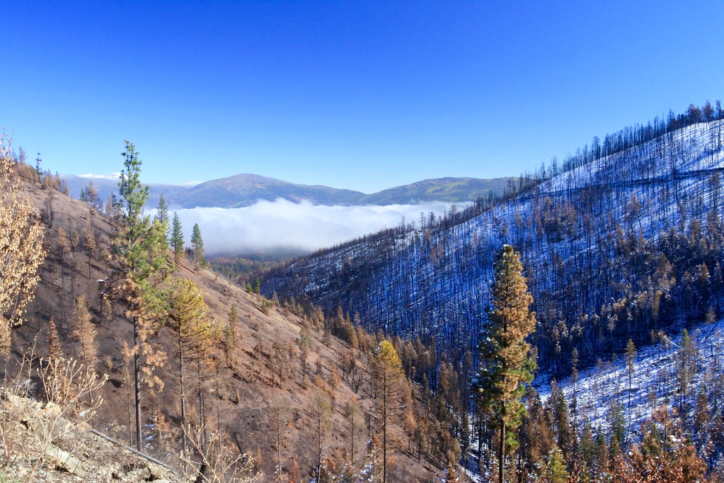
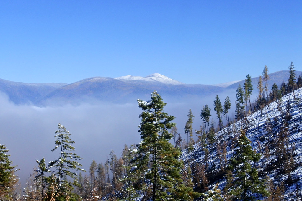
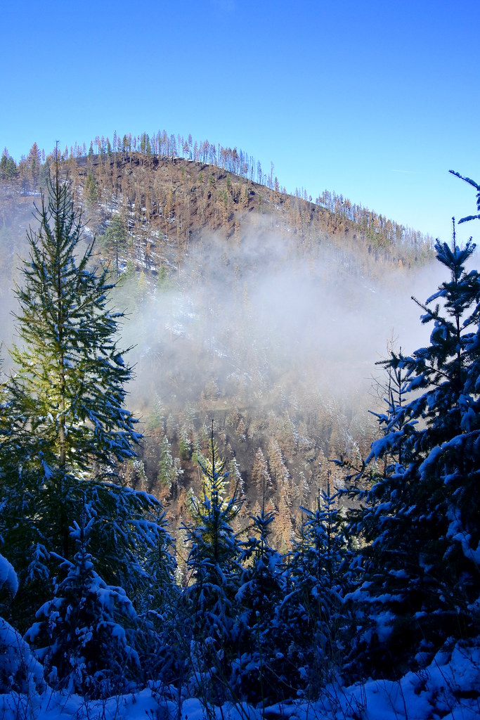
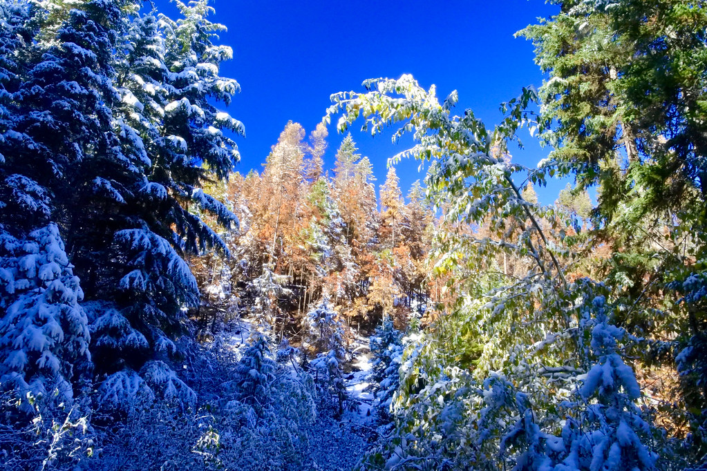
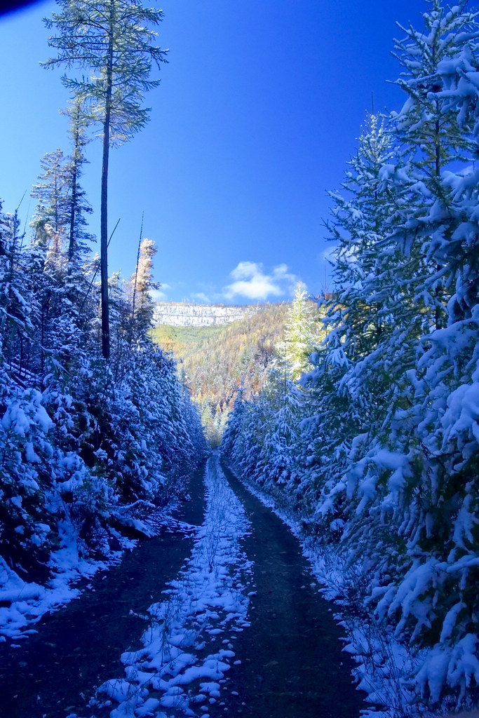
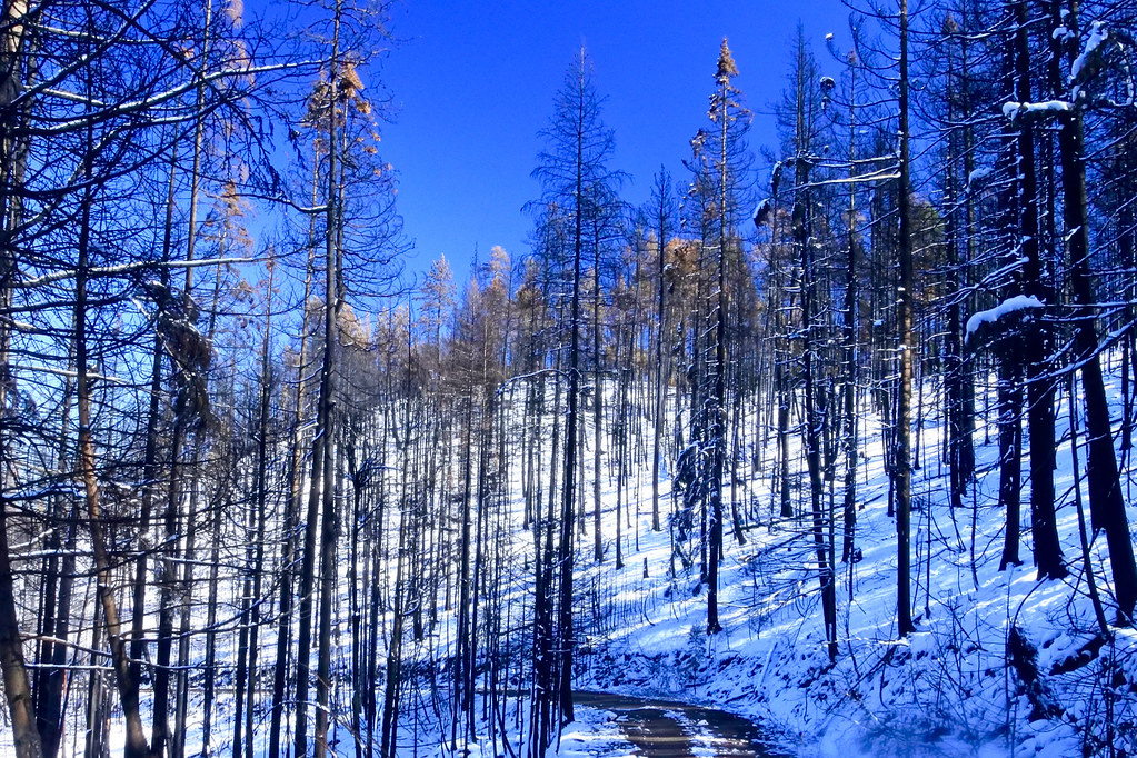
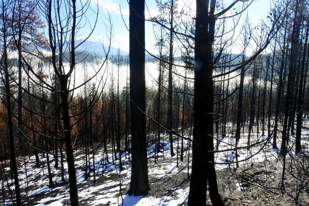
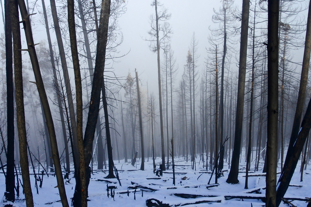
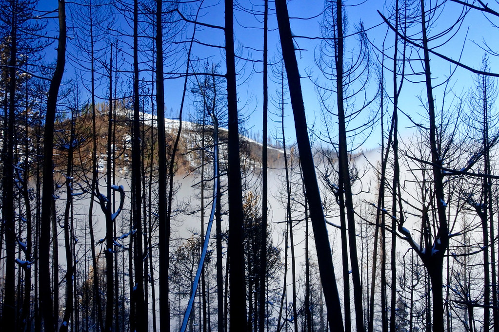
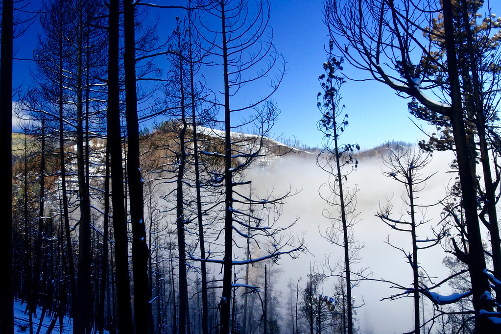
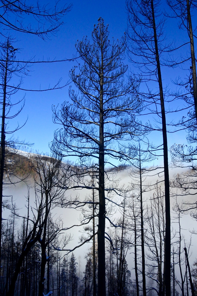
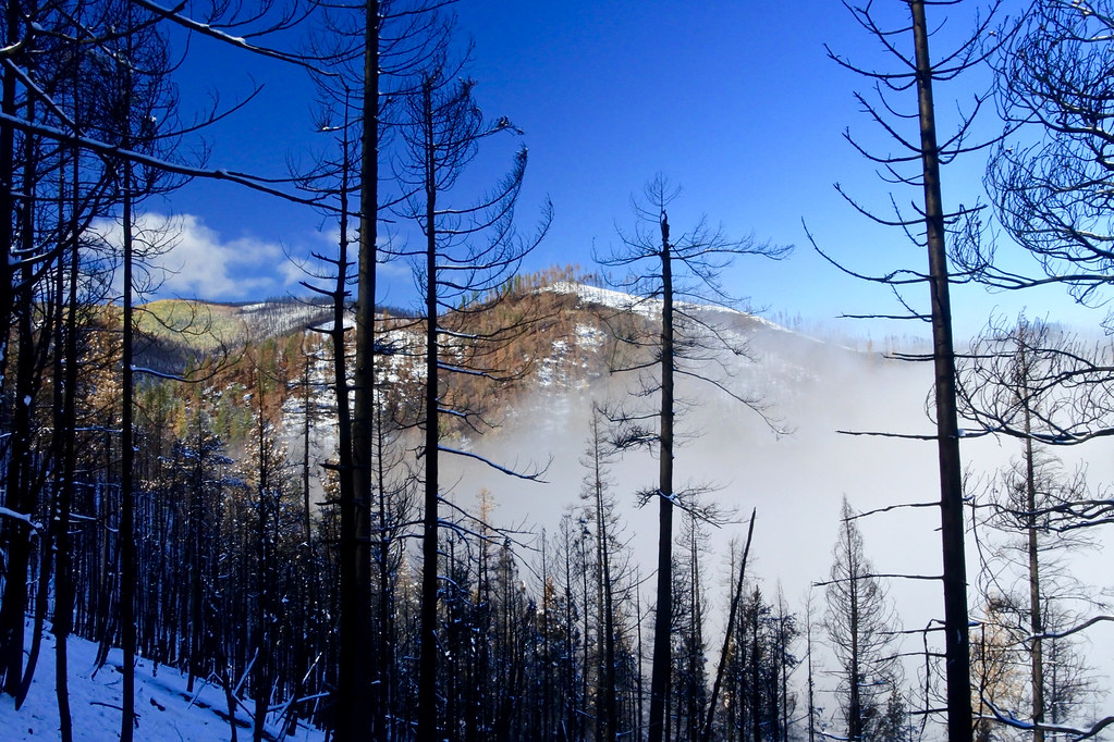
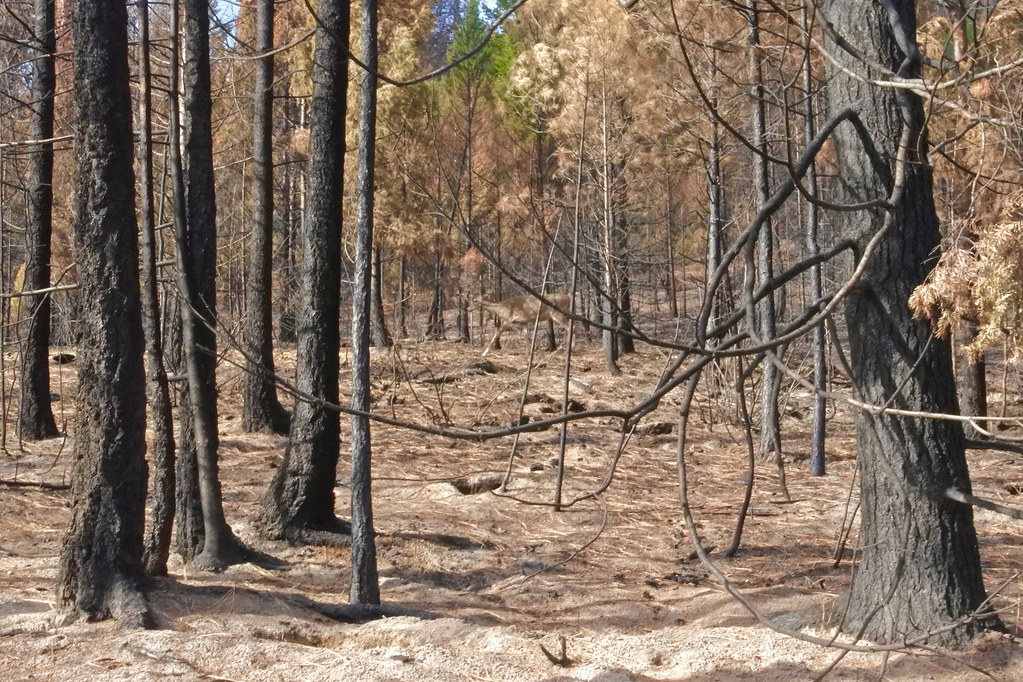
Most of the photos in the previous post showed badly burned places within the area of the Copper King fire. The photos which now follow show many areas within the fire area that escaped the flames and which will help the whole area in its recovery. All photos in these two posts were taken from within the northeast sector of the fire area. The snow-capped peak that shows up in several of the pictures is Thompson Peak which is in the area of the Chippy Creek fire which burned 150 square miles in 2007.
At the end of July a fire named the Copper King started not far from my home in western Montana. After burning for two months and covering about 45 square miles it was finally contained about the end of September and the restrictions on entering the area where it burned were removed. Due mostly to adverse weather conditions, today was the first good chance I had to go into the burn area and look around.
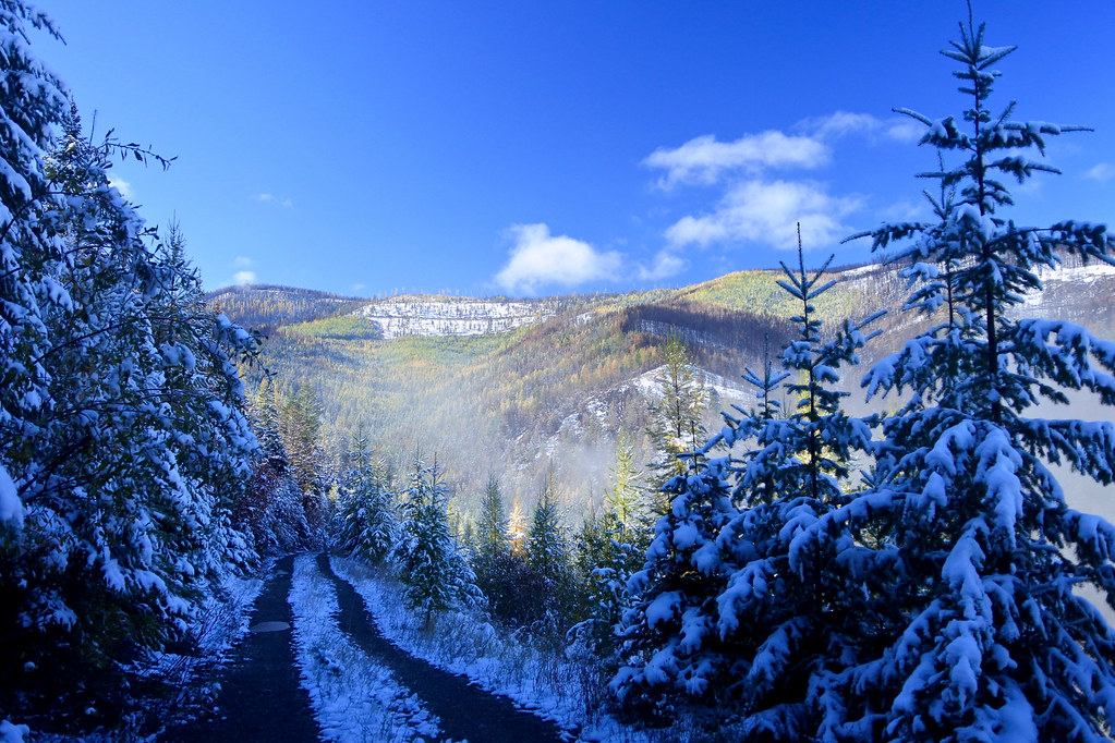
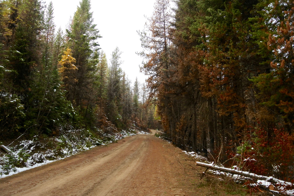
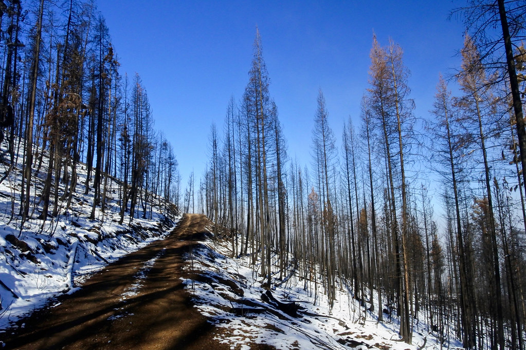
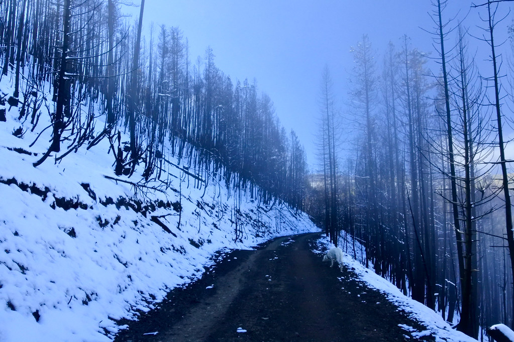
This morning a good friend and I hiked for about two miles into the burned area on USFS road 17354 which branches west off USFS road 887 about 4 miles up Todd Creek from the Little Thompson Road. In the valley the temperatures was in the upper 20’s, and when we left the Jeep, at an elevation of about 4400 feet, it was colder and there was about 4 inches of snow still on the ground left from a storm a couple of days ago. Perfect hiking weather!
A forest fire is an awesome event, unpredictable, sometimes seemingly whimsical, and its effects are far from understood by even the “experts”. Fire has always been a part of the existence of the forest and part of its natural order. Its aftermath is fascinating to see.
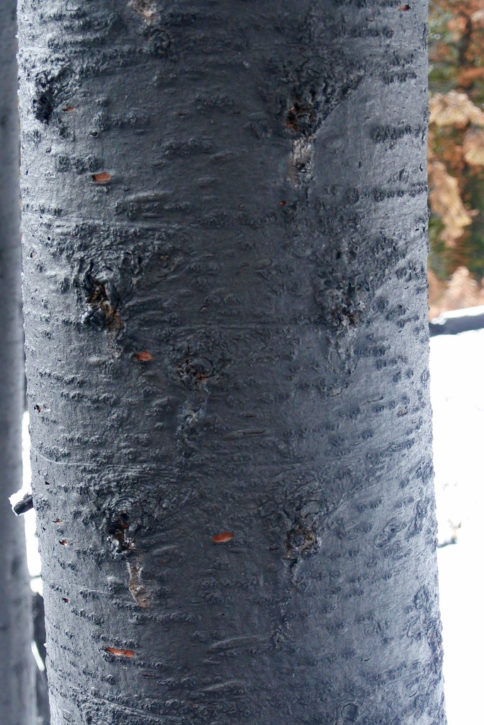
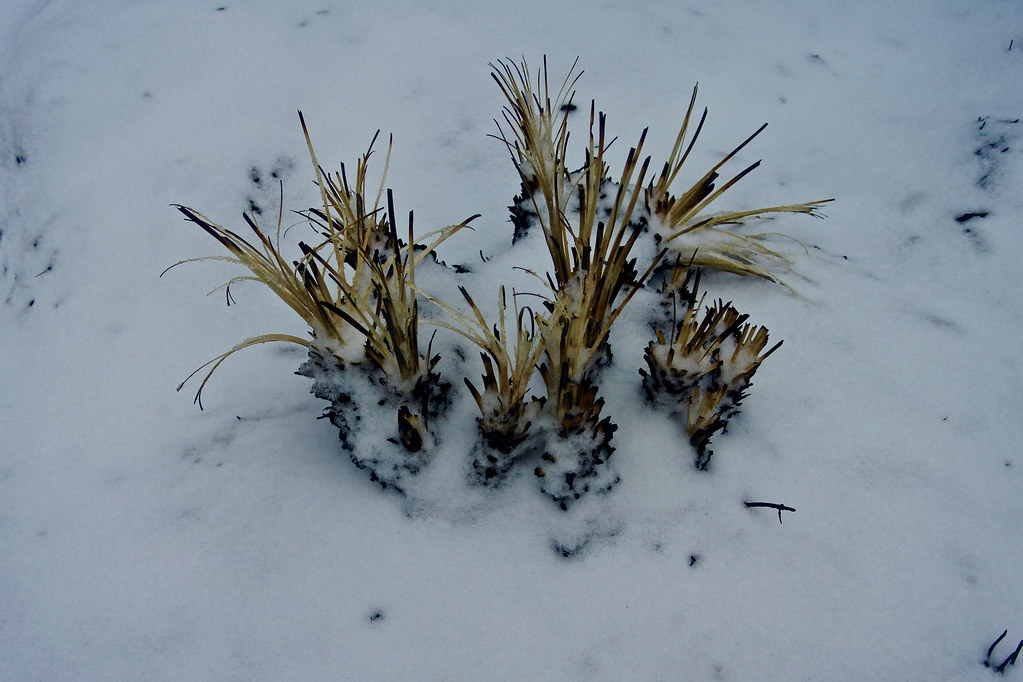
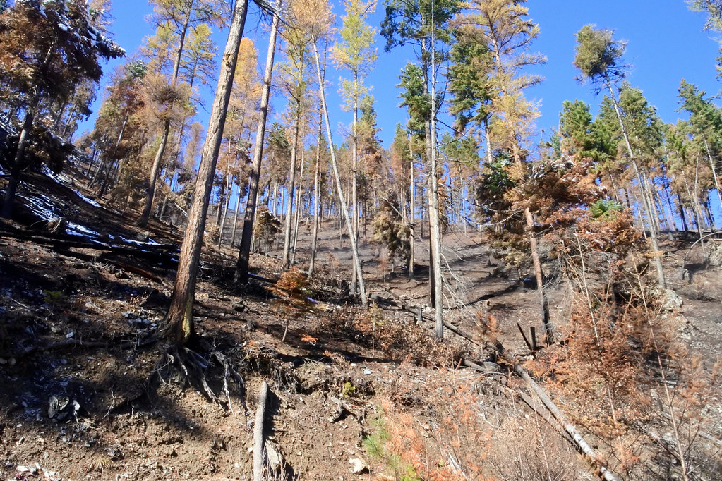
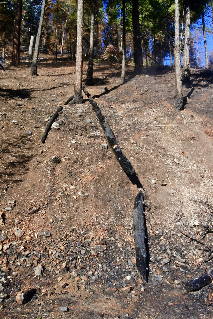
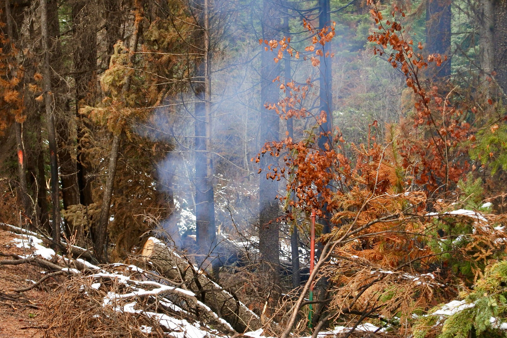
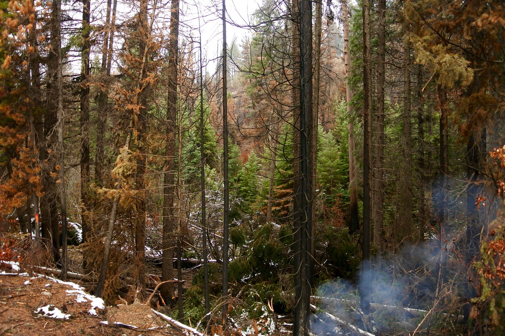
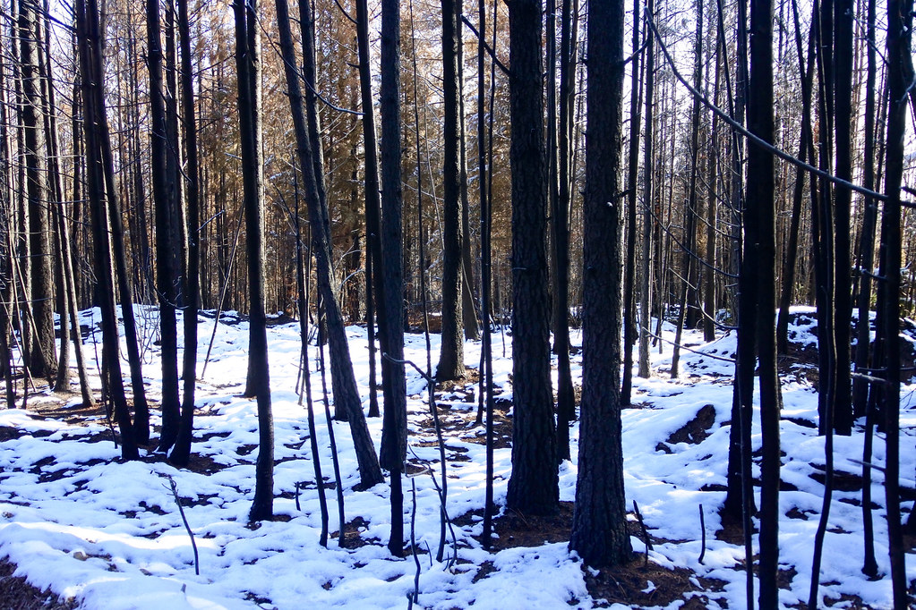
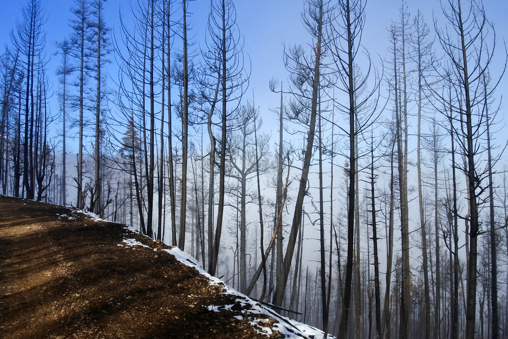
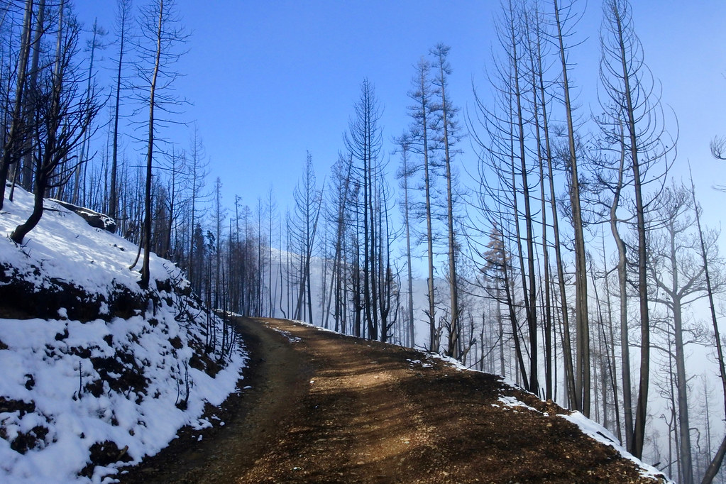
Following are 20 photos taken today on a hike into the Copper King fire burn. The first photo shows a kind of overview of the variety within the area of a large fire, from areas which were extremely hot to areas where the fire left large swaths of vegetation practically untouched. The other photos are pretty much in sequence as we hiked along the road through one of the areas which suffered intense heat and burning. I will follow up later with another post with photos that show some of the variation of fire effects throughout the rest of the area in which we hiked.
This Whitetail doe was meandering along in the burn area of the Copper King fire with her head down, sniffing the ground. I suspect she was searching for a favorite trail that no longer exists. The photo was taken in the northeastern part of the burn, along USFS road 887 about three miles up Todd Creek.
On Sunday, July 31 a wild fire started up at the west end of KooKooSint Ridge about 8 miles east of the small western Montana town of Thompson Falls at about 3:00 PM. In the first few hours it grew to 200 acres.
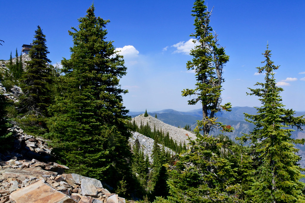
Meanwhile, a close friend was working with a contingent of volunteers on the restoration of the lookout cabin on Big Hole Peak which is located about three miles from the fire and directly down wind from it. At about 5:00 the restoration crew was evacuated from the lookout so my friend (who had hiked up to work in the morning) had the pleasure of another three mile hike back down to the staging area and return to the valley leaving most of his equipment behind.
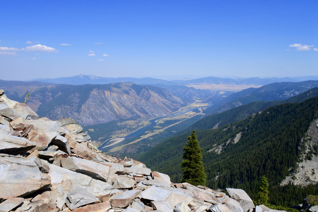
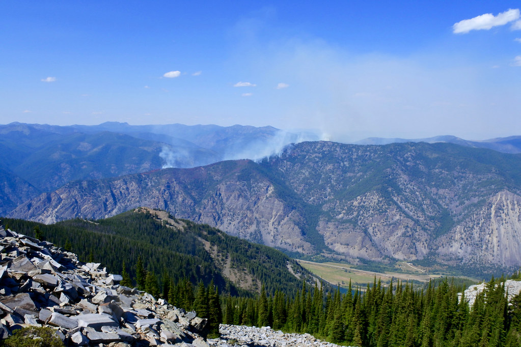
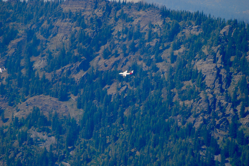
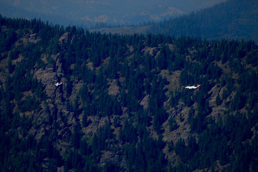
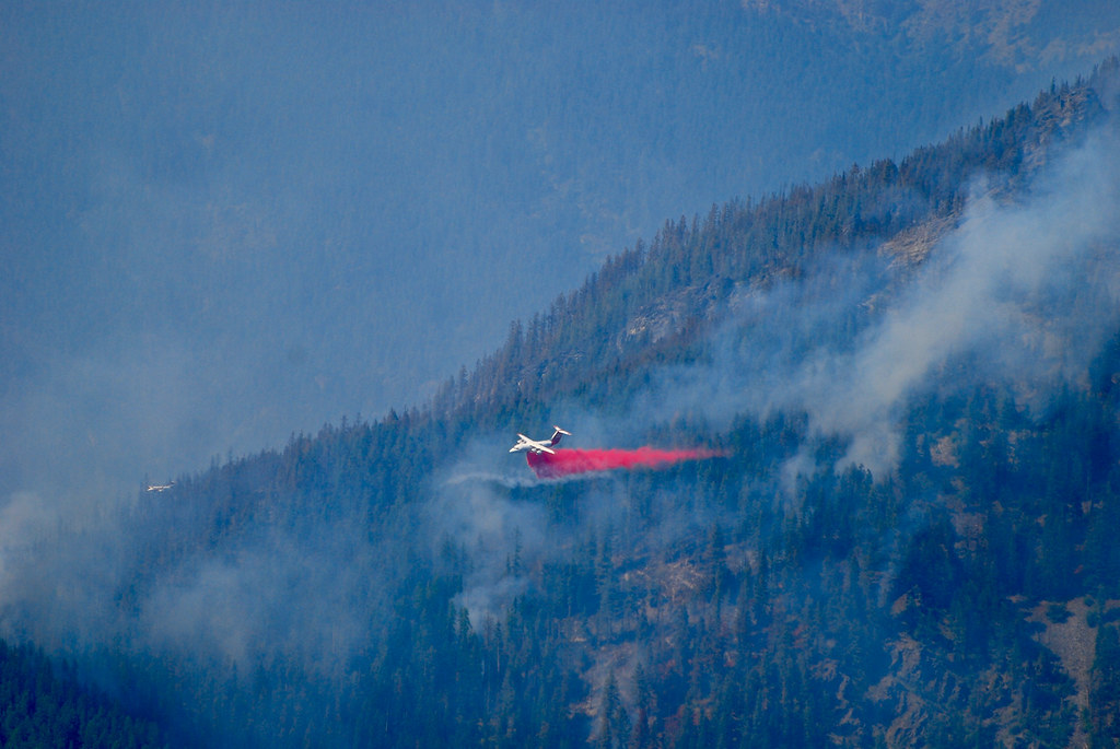
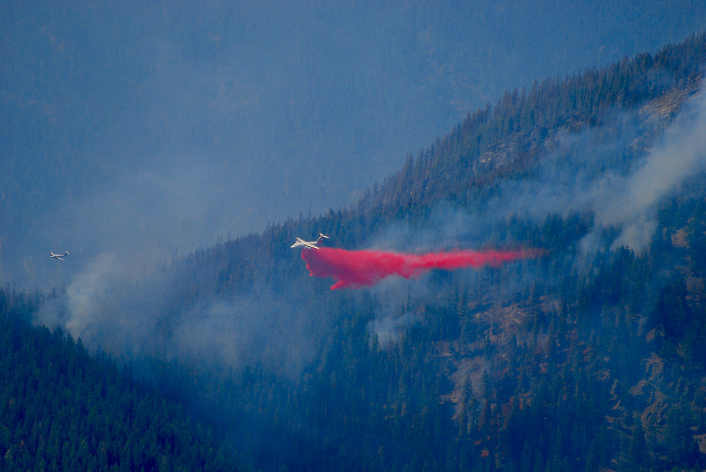
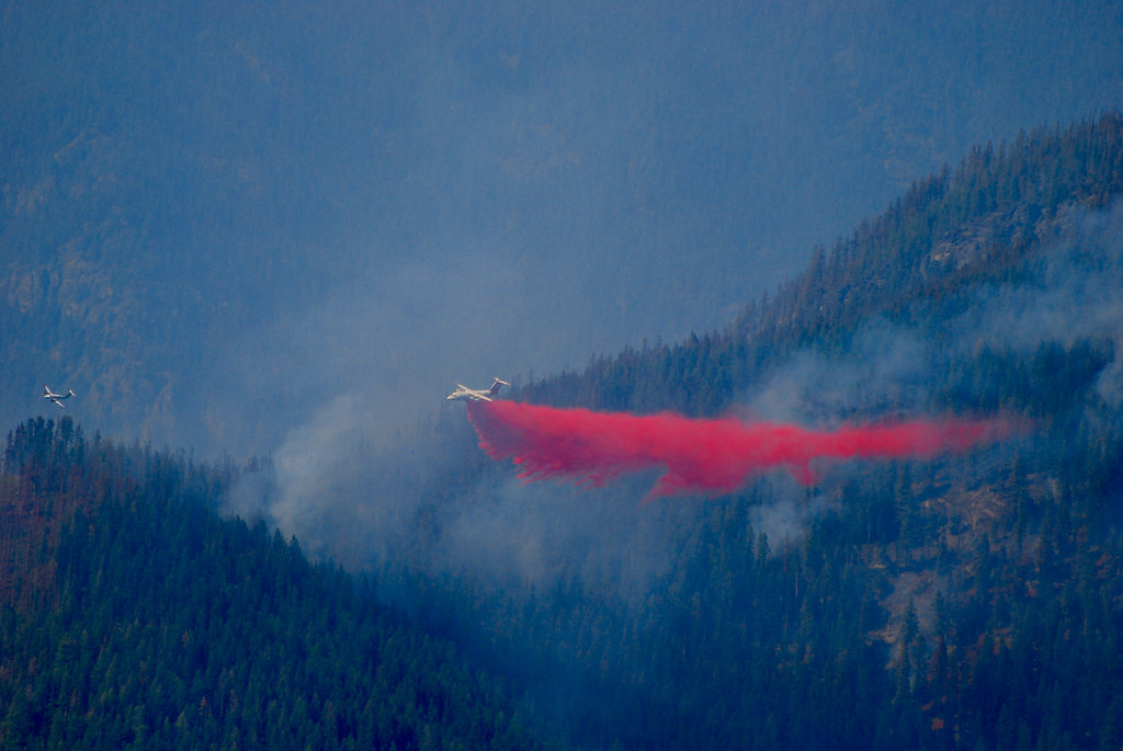
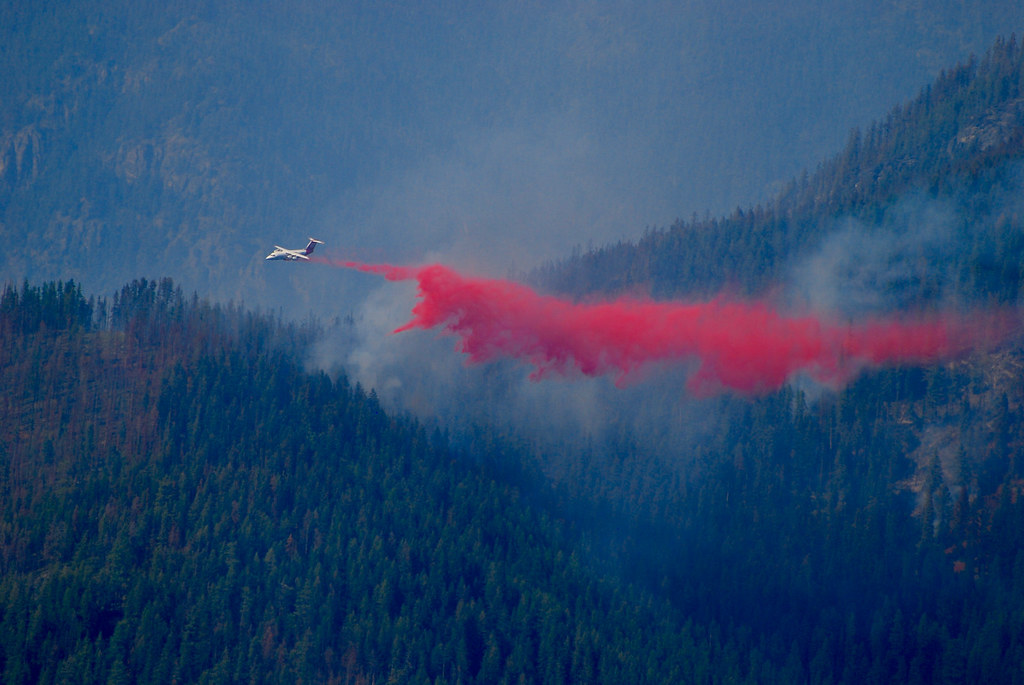
On Monday morning the Forest Service sent a crew by helicopter up to the Big Hole Lookout to retrieve all of the equipment and wrap the cabin with fire resistant material. By then the fire had grown to 700 acres. While we had nothing much else to do we decided to see if we could go get a good look at the fire, and made the drive up to the Eddy Peak lookout which is on the other side of the Clark Fork Valley about two miles due south of the fire. That lookout is manned and has a road up to about half a mile from the lookout itself. We arrived at the tower just in time to see an air tanker drop its entire load of retardant on the fire. I had barely enough time to change my camera to a telephoto lens before the retardant run began. It was a great opportunity for a few photos and a rare opportunity to photograph a big air tanker run from above. (The fire was at an elevation of about 5500 feet and the Eddy Peak lookout sits at about 7000 feet.) The photos of the tanker run were taken from the lookout tower.
The air tanker is a four engine jet I believe to be owned by Neptune Aviation in Missoula Montana and it’s a BAe 146 (#02) aircraft which carries a load of 3000 gallons of retardant (about twelve tons).
Photos from the base of the Eddy Peak lookout overlooking the Clark Fork Valley:
Sequence of photos of the air tanker retardant run: