October 11, 2014
Cabinet Wilderness trail 656 part 1.
Some time around the turn of the twentieth century near a pass in the southern part of the high mountain area in western Montana that is now known as the Cabinet Mountains Wilderness, a herder who was tending sheep was killed by lightning and a crew had to go up to gather the “bucks” and lost sheep. The pass was then named “Lost Buck Pass” and the photo in my last post was taken from there.
Today the area can be accessed on foot or horseback by several trails. The one we chose for our trip on October fifth was trail 656. To get to the trail head, turn west off U.S. Highway 2 about 17 miles south of Libby, Montana onto West Fisher Creek Road (number 231), follow it approximately 6 miles and turn south onto Road 6748; proceed about 2 more miles to the trail head.
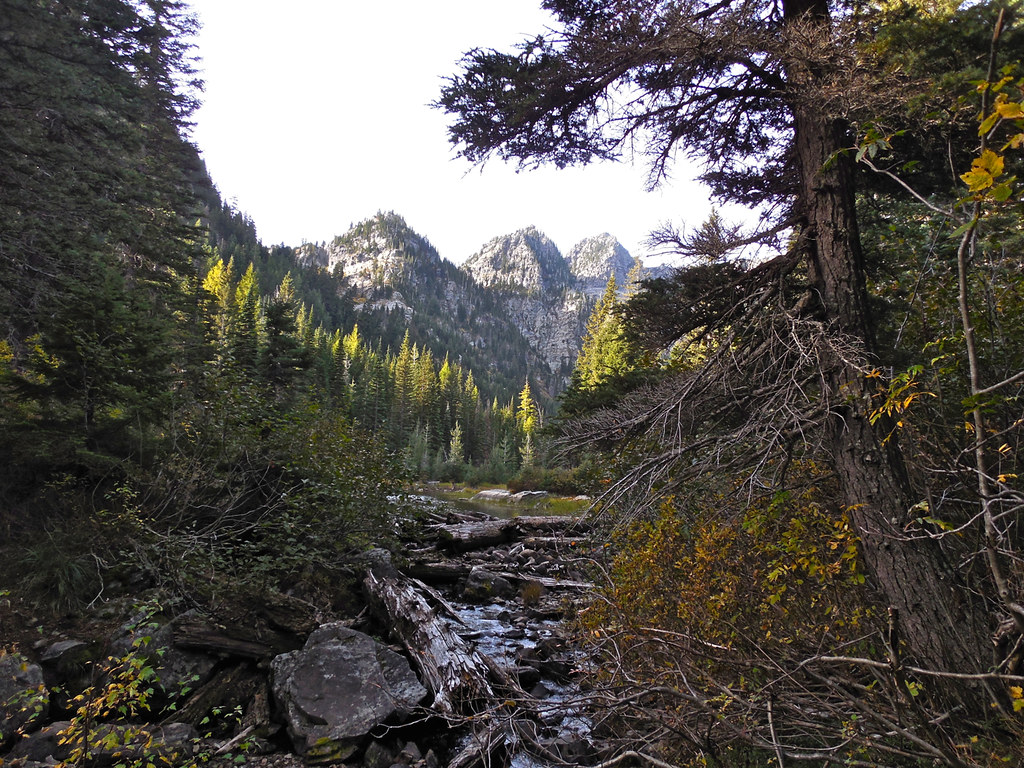
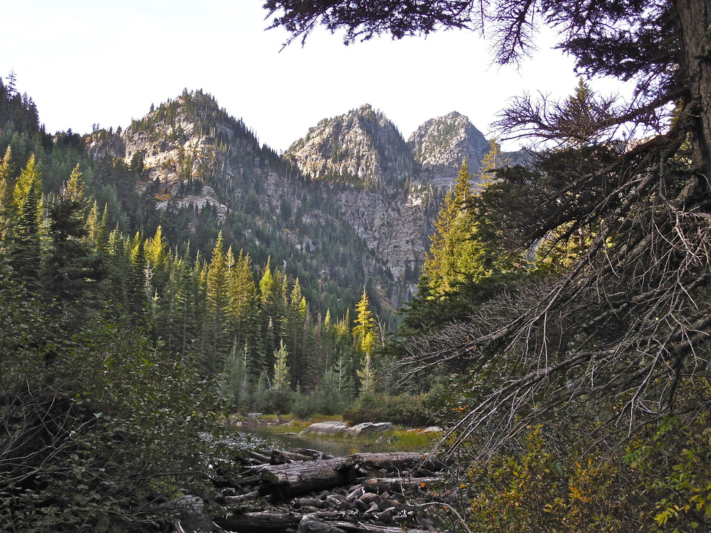
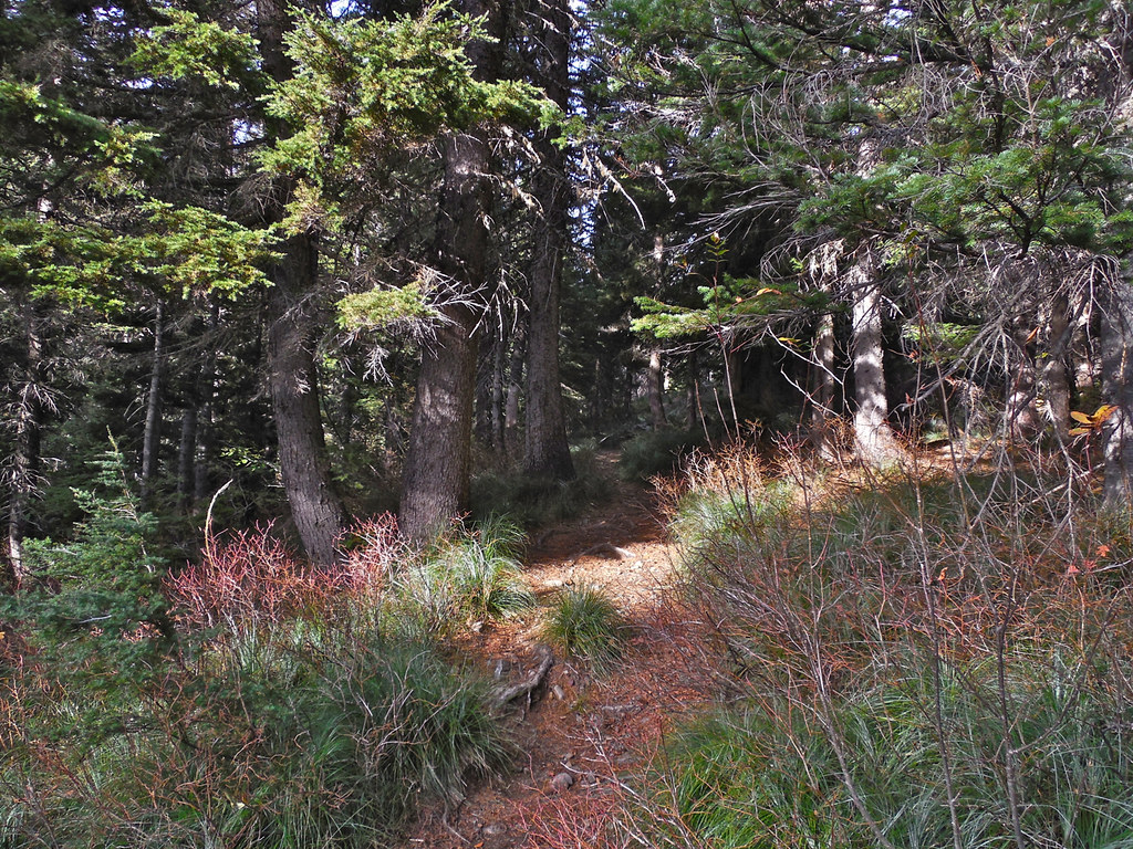
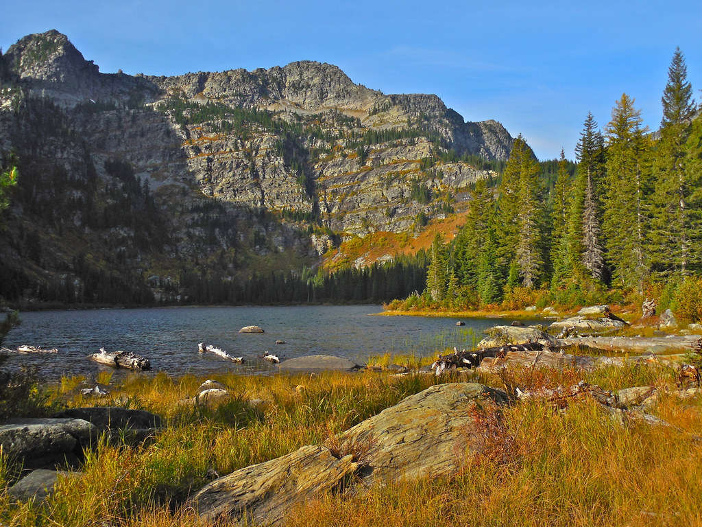
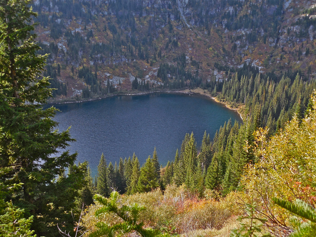
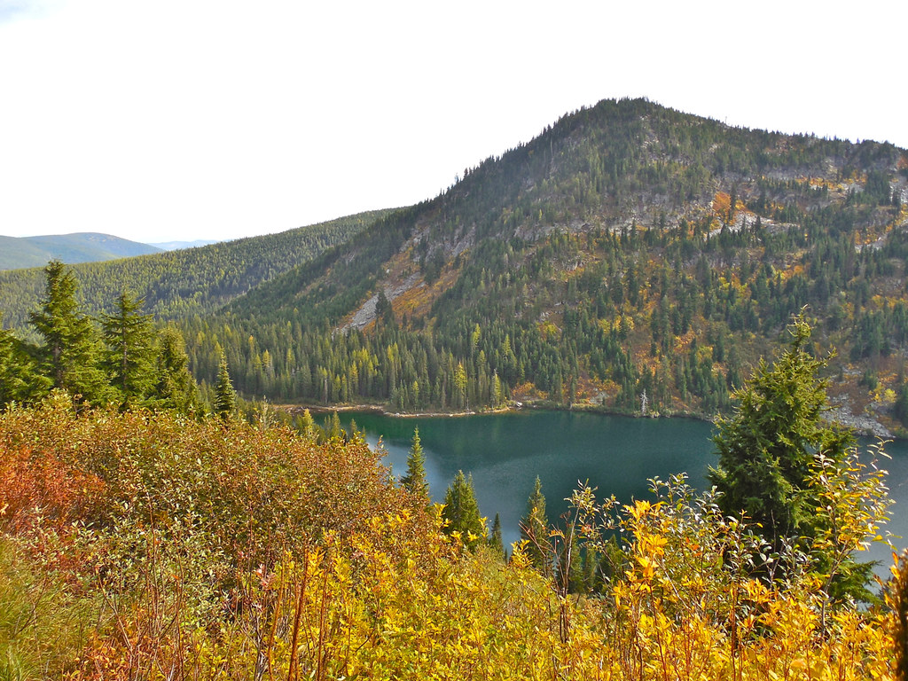
The trip from the trail head to Lost Buck pass can be roughly divided into three parts; the Lower Geiger Lake part, the Upper Geiger Lake part, and the Upper Geiger to Lost Buck Pass part. Following are some photos taken along the first of those which covers about two miles of trail and a thousand foot increase in altitude. It is a fairly easy trail and appears to get quite a few travelers. You do not enter the Wilderness until just before Lower Geiger Lake. (By the way, the lake was named after an old prospector named John Geiger who lived and prospected near and around the lake.)
RSS feed for comments on this post. TrackBack URI

Picture perfect!
LikeLike
Comment by Mother Hen — October 11, 2014 @ 10:36 pm
Thanks!
LikeLike
Comment by montucky — October 11, 2014 @ 11:14 pm
It’s fun knowing how places got their names.
LikeLike
Comment by Malcolm R. Campbell — October 11, 2014 @ 10:37 pm
Yes, fascinating. That information is usually very hard to come by though. We just never seem to document many of the things that those who follow us would find so very significant.
LikeLike
Comment by montucky — October 11, 2014 @ 11:15 pm
In a national park, it’s easier because more people are looking and keeping archives.
LikeLike
Comment by Malcolm R. Campbell — October 12, 2014 @ 11:21 am
It sure is. Here’s the link to the Kootenai Forest history if you’re interested: http://www.fs.usda.gov/Internet/FSE_DOCUMENTS/stelprdb5280687.pdf. And you might find the link in Shoreacres comment (comment no. 12) interesting as well.
LikeLiked by 1 person
Comment by montucky — October 12, 2014 @ 8:06 pm
Take care, in this very nice landscape, for bear and man.
LikeLike
Comment by bentehaarstad — October 12, 2014 @ 4:39 am
Thanks Bente. Yes, I’m pretty alert to what goes on around me in areas like that. Early in that morning we encountered a hunter who said that there was a huge pile of bear scat at the pass, and one that size would only be from a Grizzly.
LikeLike
Comment by montucky — October 12, 2014 @ 8:08 pm
What spectacular scenery and you’ve captured it so well, I almost feel as though I’m there. Love the light hitting the tree tops in the 2nd and 3rd images.
LikeLike
Comment by Vicki — October 12, 2014 @ 4:47 am
Thanks Vicki. The scenery of the entire are is beautiful, at least on the 7 trips that I have made into that Wilderness. THe Cabinet Wilderness seems to be 147 square miles of raw mountain beauty.
LikeLike
Comment by montucky — October 12, 2014 @ 8:11 pm
Beautiful photos of a beautiful area!
LikeLike
Comment by centralohionature — October 12, 2014 @ 5:25 am
Thanks. It’s quite a place! Lots more to explore there too.
LikeLike
Comment by montucky — October 12, 2014 @ 8:12 pm
Great photos Terry, the colors are spectacular, what a wonderful trail
LikeLike
Comment by Mike Howe — October 12, 2014 @ 6:37 am
That trail is another treasure. I will certainly spend more time there, especially along the trail past the pass.
LikeLike
Comment by montucky — October 12, 2014 @ 8:13 pm
This is an amazing area! Beautiful photos.
LikeLike
Comment by wordsfromanneli — October 12, 2014 @ 8:26 am
Yes, amazing it is. If I were a half century younger, I’d be looking for a home near it.
LikeLike
Comment by montucky — October 12, 2014 @ 8:13 pm
OMG! Talking in half centuries when it comes to age! Isn’t it terrifying? I’ve caught myself saying the same thing. Gulp!
LikeLike
Comment by wordsfromanneli — October 13, 2014 @ 7:54 am
Problem is, I’m not very happy about so many of the things that have gone on in the last half century!
LikeLiked by 1 person
Comment by montucky — October 13, 2014 @ 3:47 pm
Comparisons are impossible, but this is certainly some of your best stuff; I loved the views, great photos.
LikeLike
Comment by Charlie@Seattle Trekker — October 12, 2014 @ 1:01 pm
Thanks Charlie. I still have a few more photos to post of the upper lake and the pass area, and there is still a huge amount of territory in that area to explore.
LikeLike
Comment by montucky — October 12, 2014 @ 8:15 pm
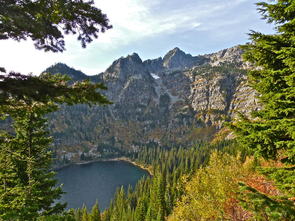
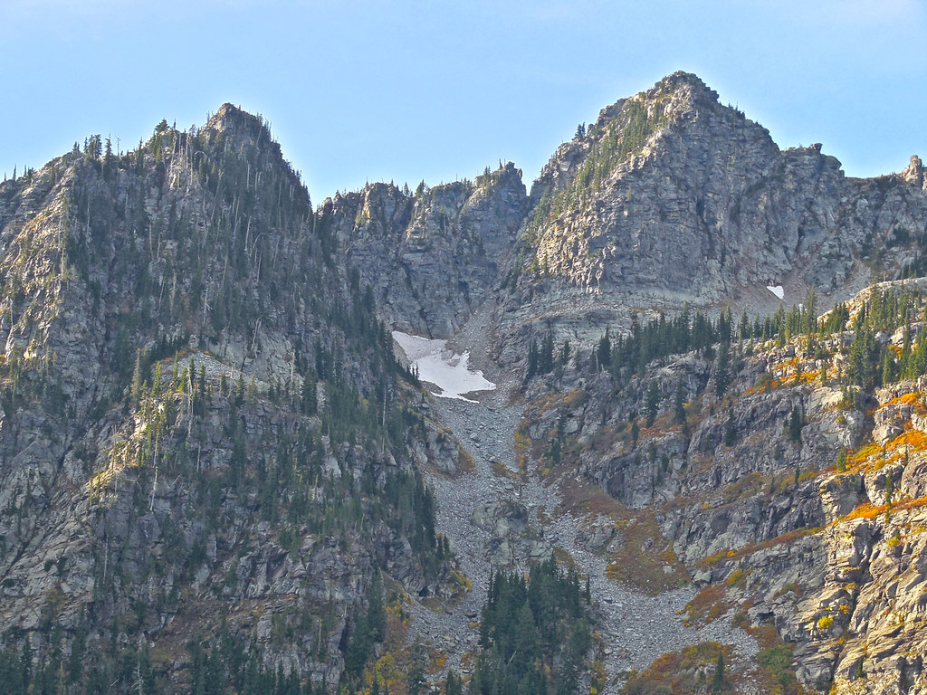
I love seeing the evergreens growing where and how nature intended. I thought that was snow on those 3 peaks but I guess it’s just light colored stone. I’m assuming the larger patch of snow is left over from last year. Maybe it’s a glacier in the making.
That looks like quite a hike down to the lake!
LikeLike
Comment by New Hampshire Garden Solutions — October 12, 2014 @ 3:37 pm
Yes, those evergreens are natural, although by their size, in part of the area I think there must have been a pretty big fire within the last century. There is a glacier still remaining in an area about a dozen miles north of there, but that is just a snow bank that will make it into the following winter. That if the result of a good snowfall last winter. The lakes are full to their normal point and the creeks and streams are all healthy.
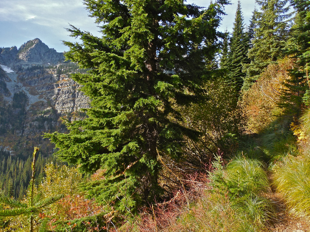
Some of the photos were taken from the trail above the lakes on the way up to the pass. It climbs about 1200 feet from the lake level to the pass, about half of which is between the lakes.
LikeLike
Comment by montucky — October 12, 2014 @ 8:20 pm
After looking on a satellite view of the area this seems to be “just over” the mountain ridge from Wanless lake where you last posted from. Looking forward to pics from the upper lake and then the pass. Take care
LikeLike
Comment by Ron Mangels — October 12, 2014 @ 4:34 pm
Exactly, Ron. Google Earth shows the trail through the pass quite clearly where it is above the forest. The lower part is hidden in the trees.
LikeLike
Comment by montucky — October 12, 2014 @ 8:21 pm
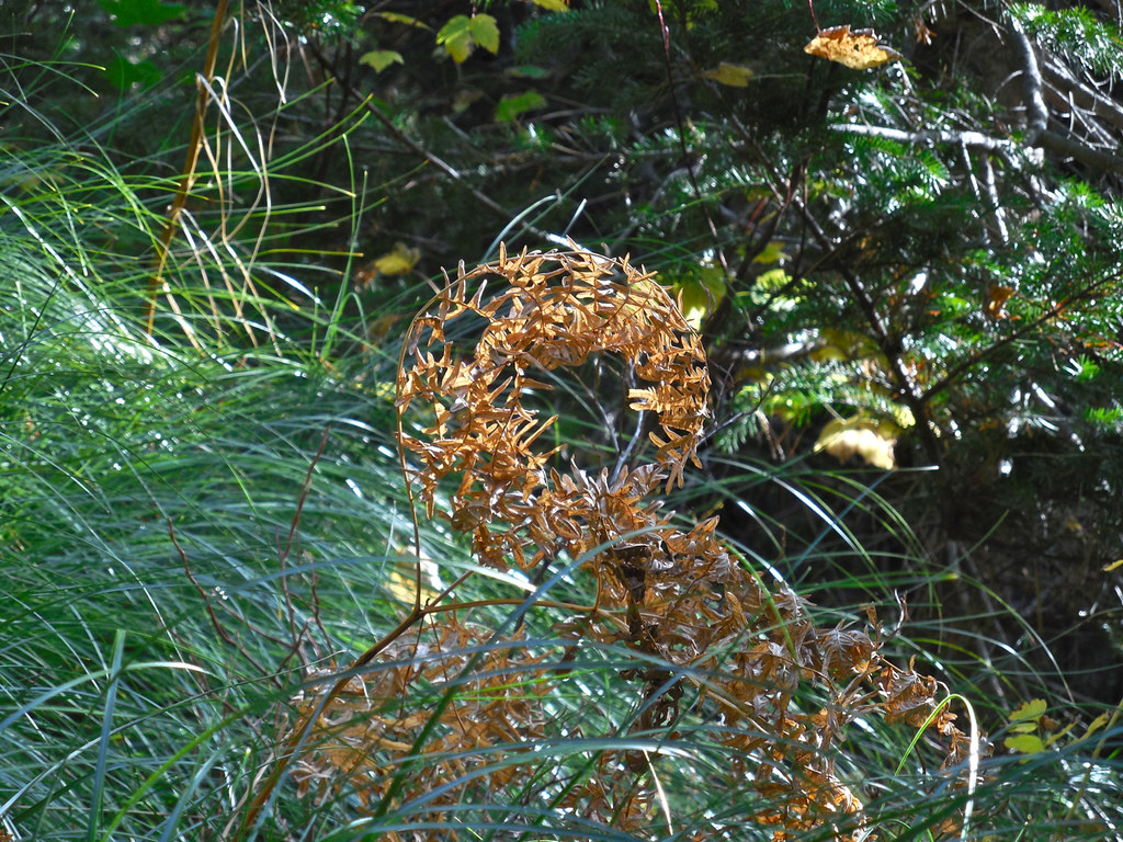
So beautiful – mountains lake trees. What’s the bush/flower that looks like a wreath?
LikeLike
Comment by Lynn Millar — October 12, 2014 @ 5:26 pm
The wreath was just a large fern that had curled up as it matured and dried. I considered it a trail decoration.
LikeLike
Comment by montucky — October 12, 2014 @ 8:22 pm
Is it my imagination, or my bad memory? It seems to me the peaks in these photos are sharper than some of the others you’ve shown us. Or, perhaps they’re smaller? There just seems to be some kind of difference. They’re really beautiful, and have a feeling of being accessible.
As for Mr. Geiger, I just enjoyed my way through this rather extensive article, written by a woman who ended the piece by saying, “My research into the life of John H. Geiger proved to be more interesting than I had expected. My interest came from the fact that my parents, John and Deena Shotzberger, own sections of the land that Geiger homesteaded.” If you haven’t read this, I think you’ll find it pretty interesting — to say the least!
LikeLike
Comment by shoreacres — October 12, 2014 @ 5:44 pm
Some of the photos were taken from different angles than the first time when we arrived at the lake in a snow/rain storm and didn’t go any further. This time we went far beyond and some photos were taken from above.
I loved that article and saved the link to my file on the Cabinet Wilderness. I don’t know how you found that, but thanks, I really appreciate it! Appears that the political climate of the area has change little over the last century. There is a place along the trail about half the way up to the lake where there is a large depression that normal geology doesn’t explain. Now I’m pretty sure that it was one of Geiger’s prospecting efforts.
LikeLike
Comment by montucky — October 12, 2014 @ 8:03 pm
Another enjoyable hike…thanks for “taking me along” to see the beauty. The wreath photo was an unexpected treat! The history is interesting and a tribute to the hardy souls who lived on and worked in the area! Thanks!
LikeLike
Comment by Beth — October 13, 2014 @ 7:33 am
I’m glad that you enjoyed it, Beth!
LikeLike
Comment by montucky — October 13, 2014 @ 3:23 pm
I’ve had a busy morning but your photos (as always) stopped me in my tracks, and I just had to sit and drink them in. Absolutely beautiful. The last three shots in particular are breathtaking!
LikeLike
Comment by Jo Woolf — October 13, 2014 @ 8:02 am
It’s a rough and raw beauty, but I sure love it.
LikeLike
Comment by montucky — October 13, 2014 @ 3:48 pm
I love reading how different places got their names. We have a ton of such named places around here – Dutch Hollow, Hogback Hill, just to name a couple. Gorgeous photos, as always!
LikeLike
Comment by Mama's Empty Nest — October 13, 2014 @ 9:41 am
Yes, place names are fascinating. I know there’a story behind nearly every one. I remember a place in a very remote part of the Arizona high desert called “Lion Spring”. One time when I visited it there was mountain lion there.
LikeLiked by 1 person
Comment by montucky — October 13, 2014 @ 3:50 pm
Hi Montucky, Thanks for taking beautiful photographs to share with us. I feel like I have virtually hiked. Beautiful wild country. Love that last picture of the lake, peaks, and fall foliage. Wonderful! Have a happy coming week!
LikeLike
Comment by wildlifewatcher — October 13, 2014 @ 10:42 am
I’m glad that you enjoy seeing some of the scenic Montana wild country! You have a great week too!
LikeLike
Comment by montucky — October 13, 2014 @ 3:51 pm
Magnificent landscape photos … Fantastic colors ! …
Love your post as always … Wish you all the best Terry !
// Maria 🙂
LikeLike
Comment by mariayarri — October 13, 2014 @ 7:56 pm
Thank you Maria!
LikeLike
Comment by montucky — October 13, 2014 @ 8:34 pm
I’d be happy to just see the lower lake, how lovely.
LikeLike
Comment by Candace — October 15, 2014 @ 12:04 pm
We had seen the lower lake last year . We got that far before being snowed/rained out. I wanted all summer to see it again and then go the rest of the way to the Cabinet Divide.
LikeLike
Comment by montucky — October 15, 2014 @ 7:20 pm
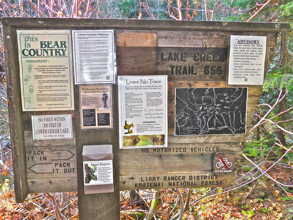
I like the ‘this is bear country’ sign. Here in Ohio we only have tick warnings!
LikeLike
Comment by Watching Seasons — October 17, 2014 @ 5:31 pm
They don’t say it directly, but the warning is really about the Grizzly, which is dangerous.
LikeLike
Comment by montucky — October 17, 2014 @ 7:25 pm