September 9, 2014
Bear – Baree Lake loop ~ Cabinet Mountains Wilderness
This is a photo tour of a loop hike on August 29, 2014 through the southeast tip of the Cabinet Mountains Wilderness. It started with USFS trail 178 at road 148 (3700 feet elevation) to USFS trail 63 then on 63 to USFS trail 360 (the Cabinet Divide trail at 6400 feet elevation). From there, south down the Cabinet Divide a mile and a half or so to USFS trail 489 and back down it about 5 miles to road 148 and up the road to the starting point. The total distance was about 11.5 miles and took 10 hours of hiking.
You can follow the route, the access road and the trails on the Kootenai National Forest Cabinet Ranger District map. (Note: Trail 531 is the old trail number to Bear Lakes: now the same trail is shown on all of the maps as trail 178.)
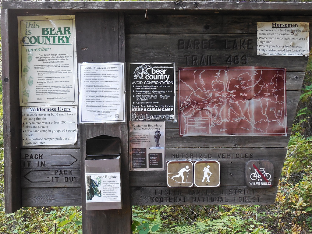
Trail head at USFS trail 489, Kootenai National Forest
Trail 178, Kootenai National Forest
Trail 178 gains elevation very sharply. Kootenai National Forest
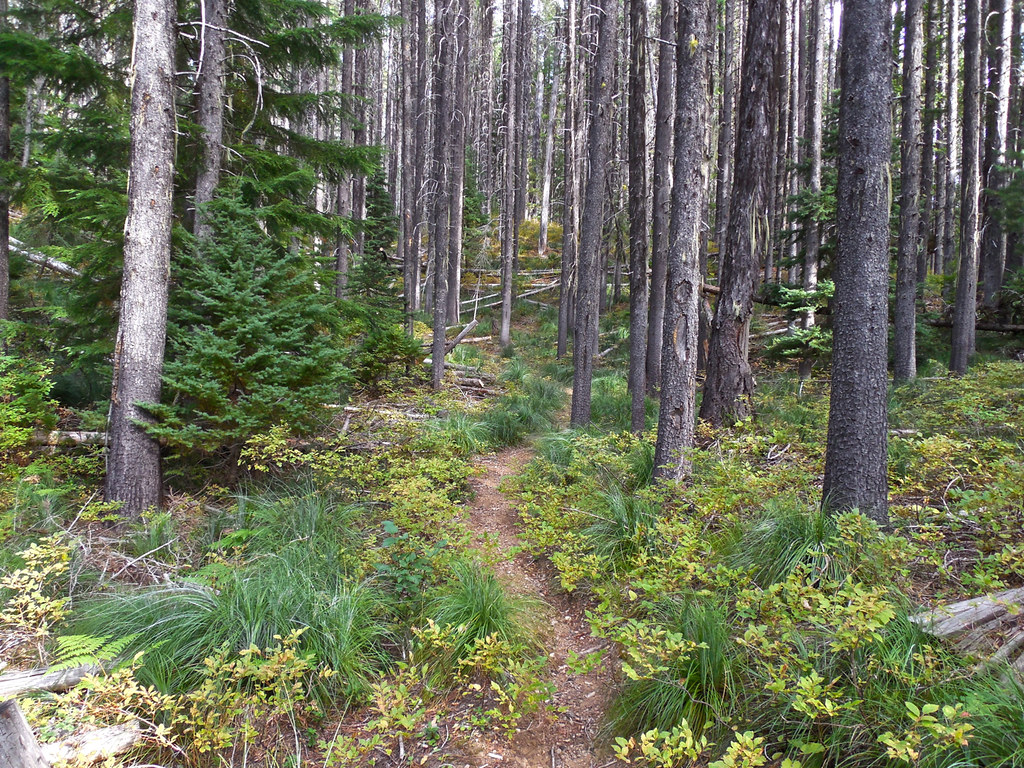
Trail 63, Kootenai National Forest
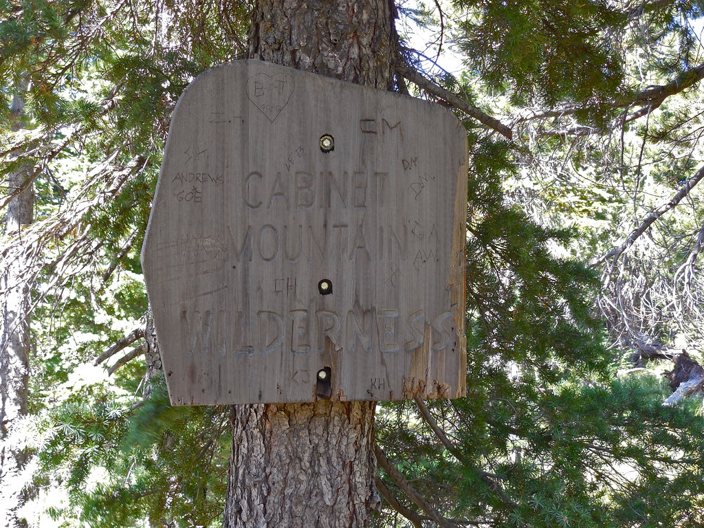
Trail 63, Cabinet Mountains Wilderness
Trail 63, Cabinet Mountains Wilderness
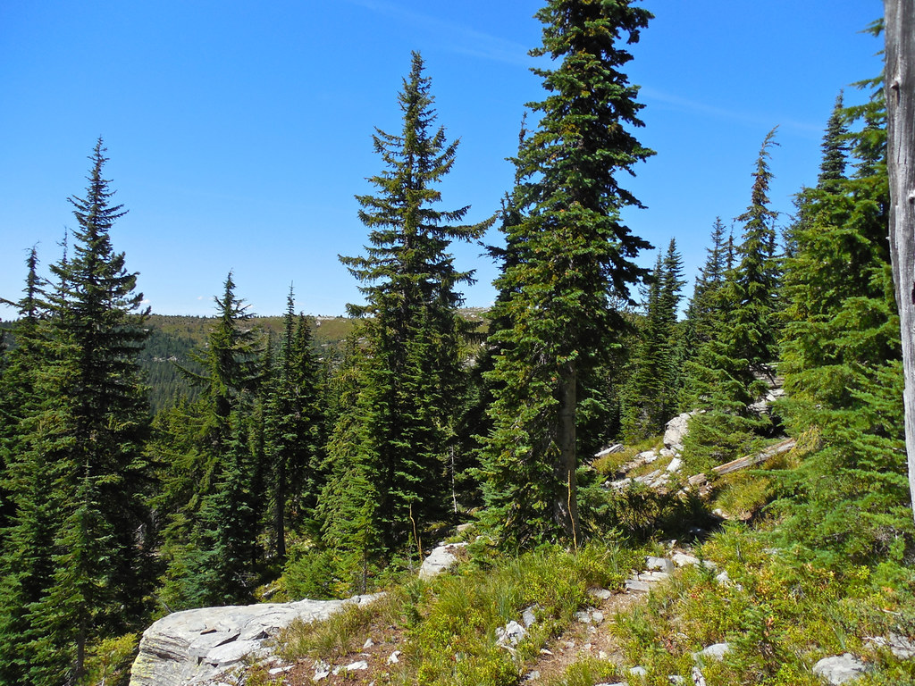
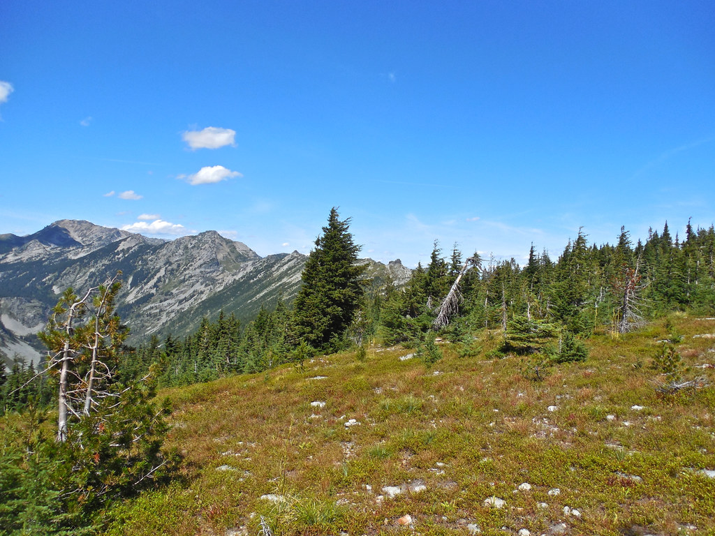
Trail 63, Cabinet Mountains Wilderness
Trail 63, Cabinet Mountains Wilderness
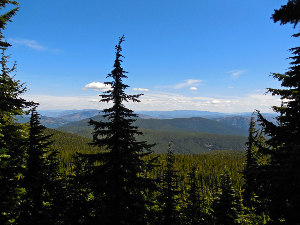
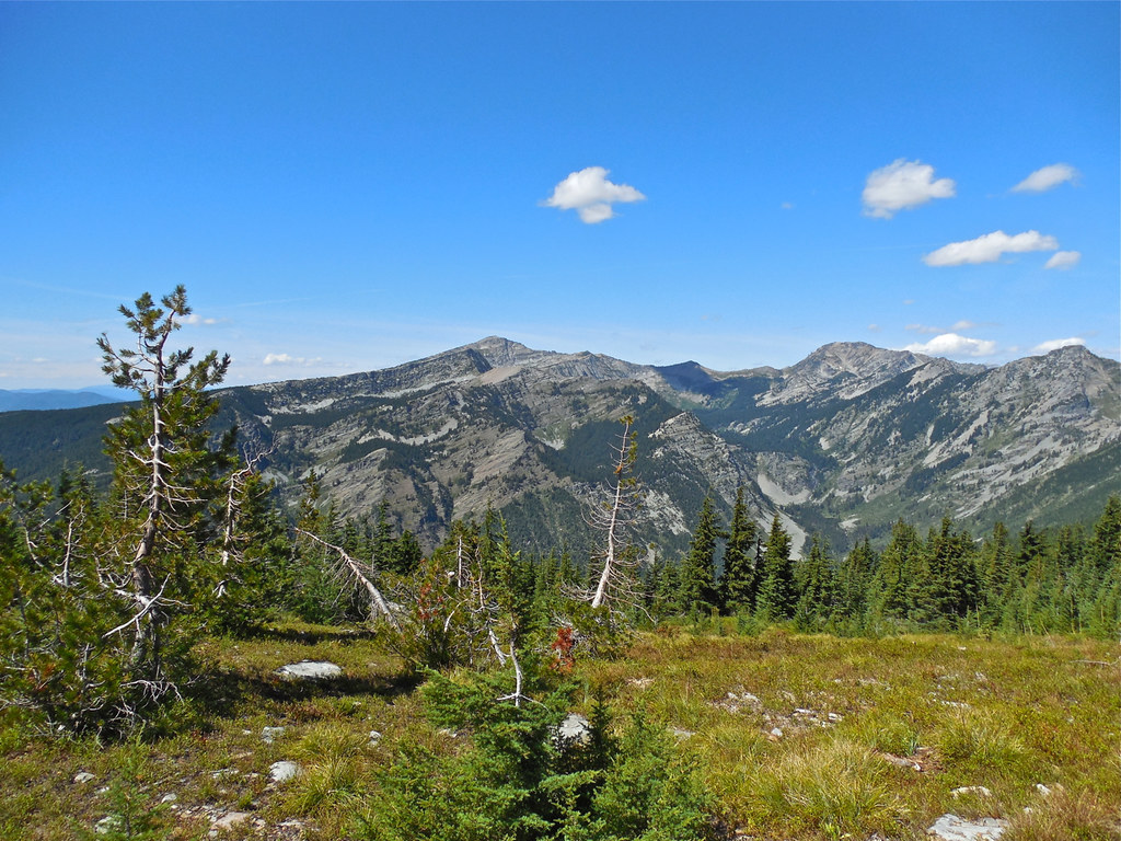
Trail 63: Cabinet Divide in the distance – Cabinet Mountains Wilderness
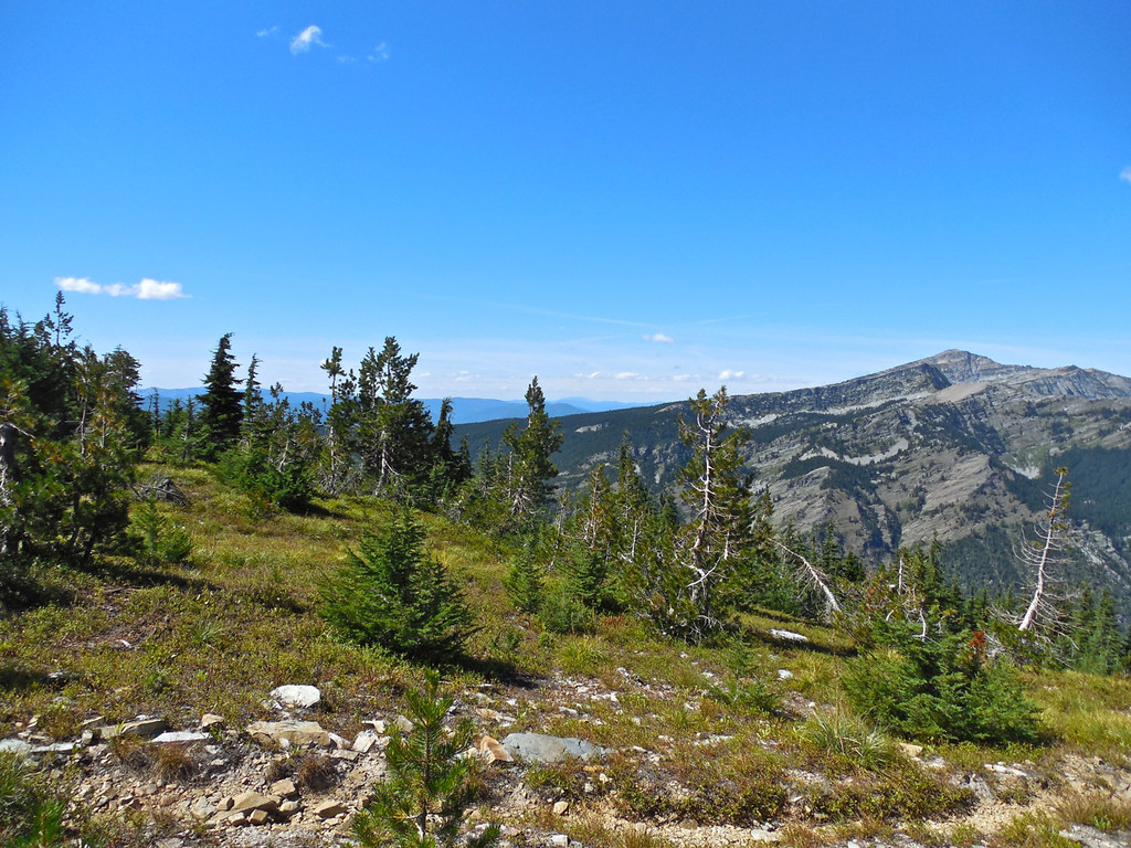
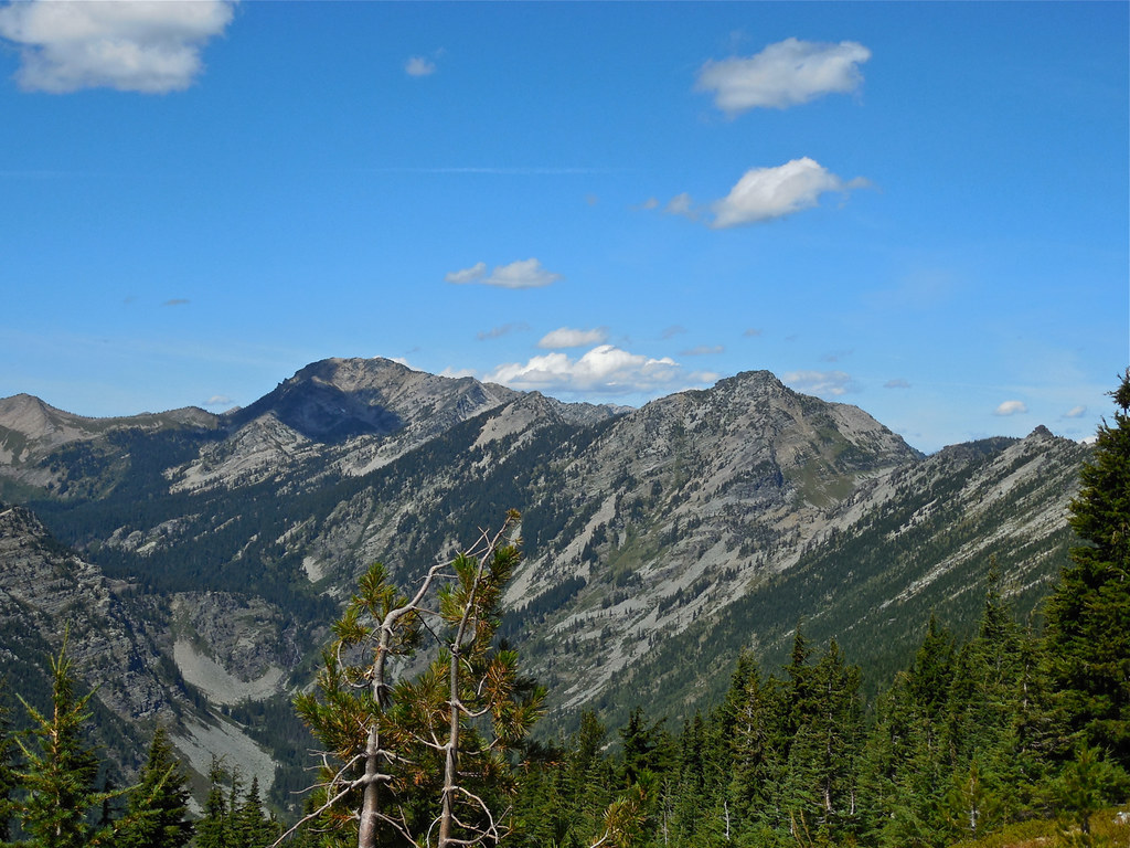
Trail 63: Baree Mountain at the left of the photo. It is at the southern edge of the wilderness.
Trail 63: Baree Mountain, Cabinet Mountains Wilderness
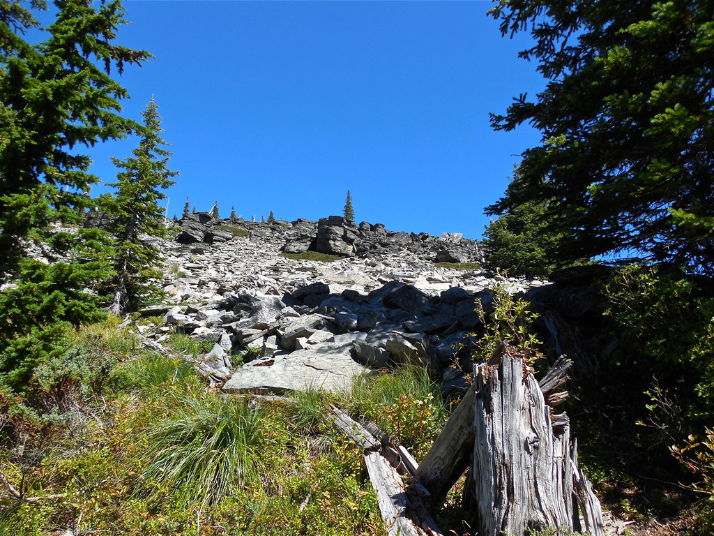
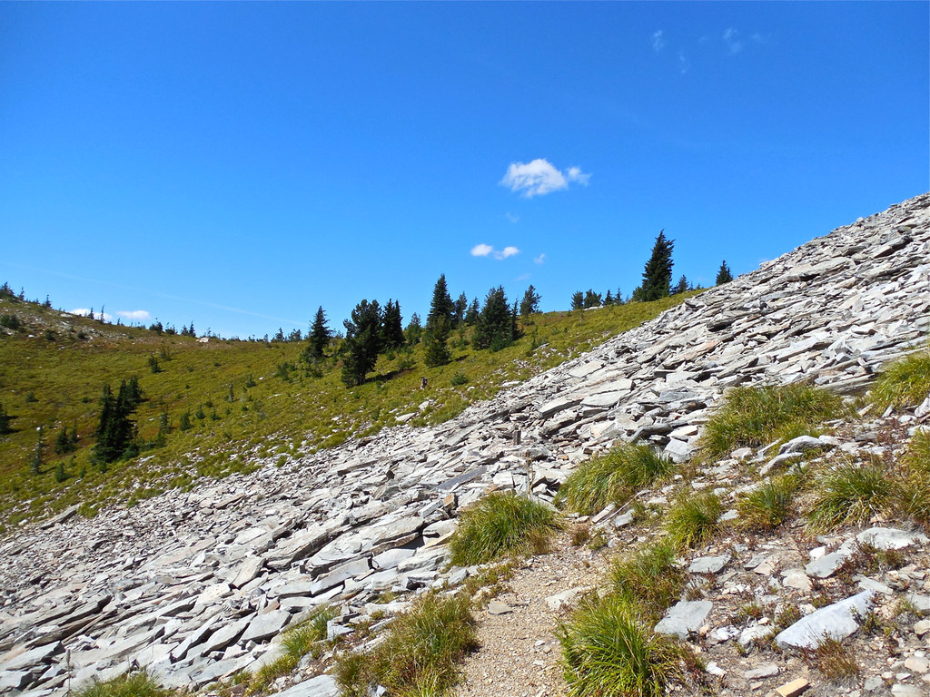
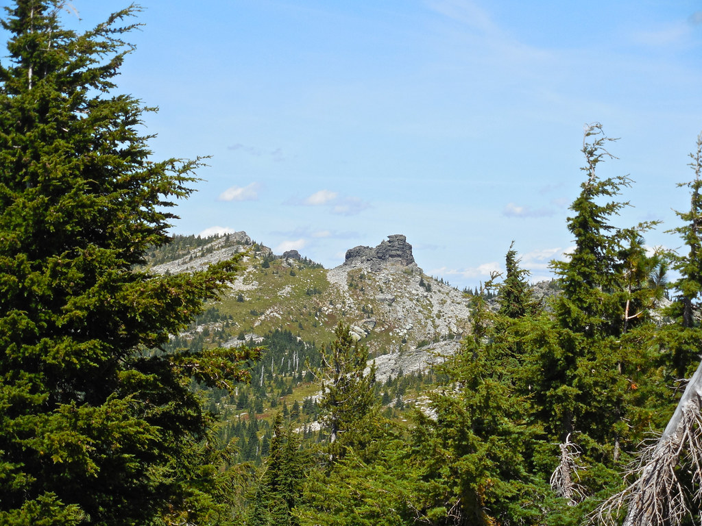
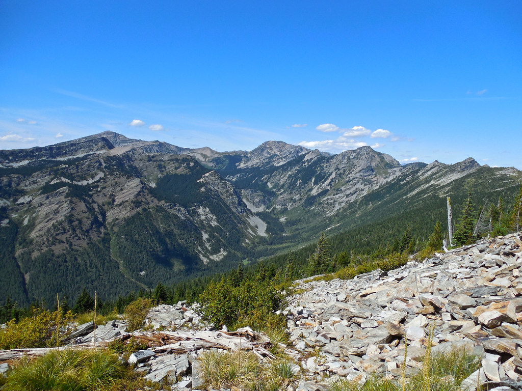
Trail 63: South side of Cabinet Divide, Cabinet Mountains Wilderness
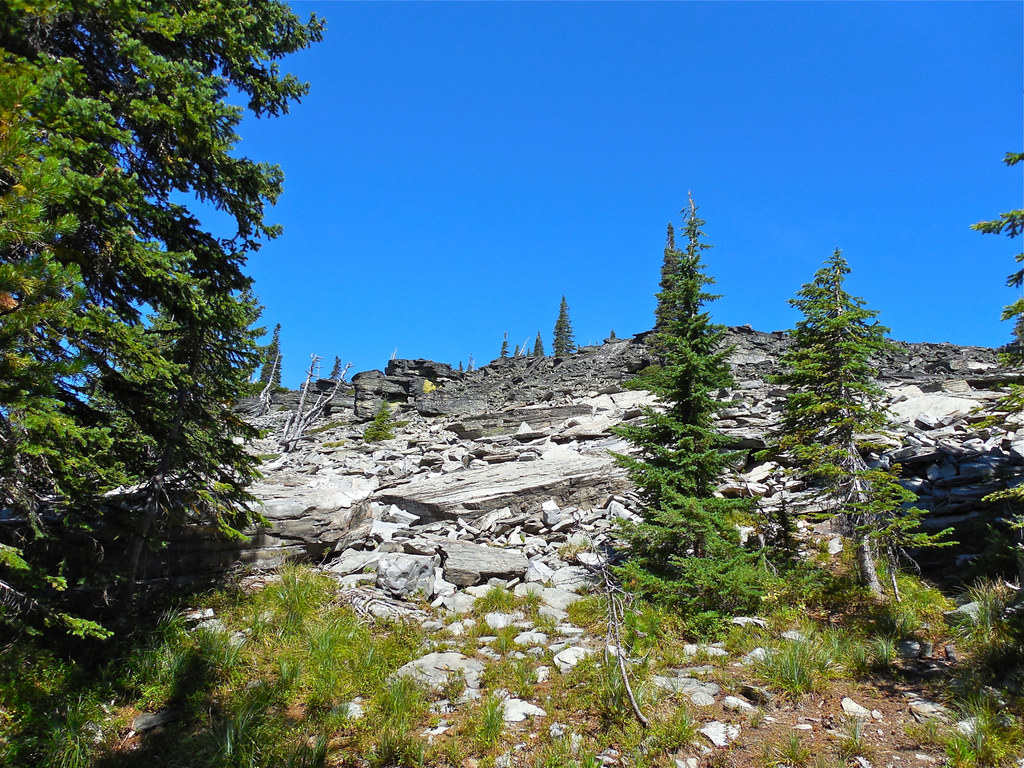
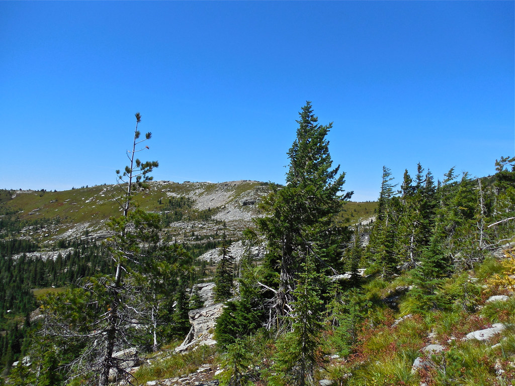
Trail 63, Cabinet Mountains Wilderness
Trail 63, Cabinet Mountains Wilderness
Trail 63, Cabinet Mountains Wilderness
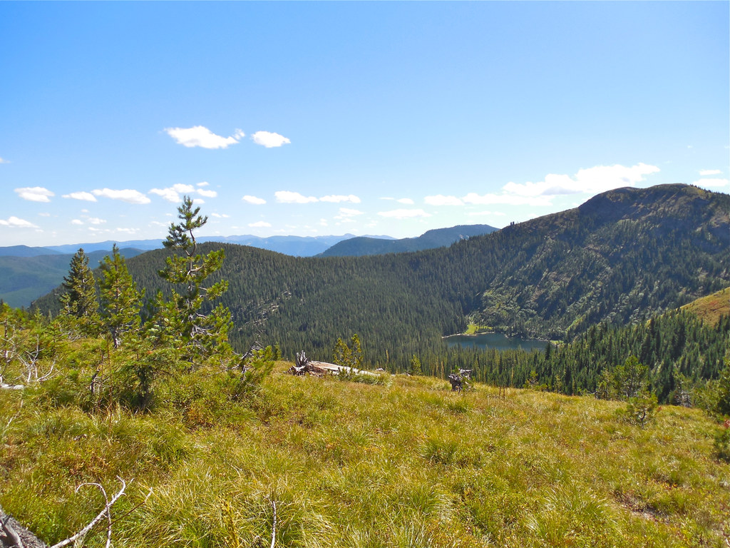
Trail 63: Looking down into Baree Lake Basin, Cabinet Mountains Wilderness

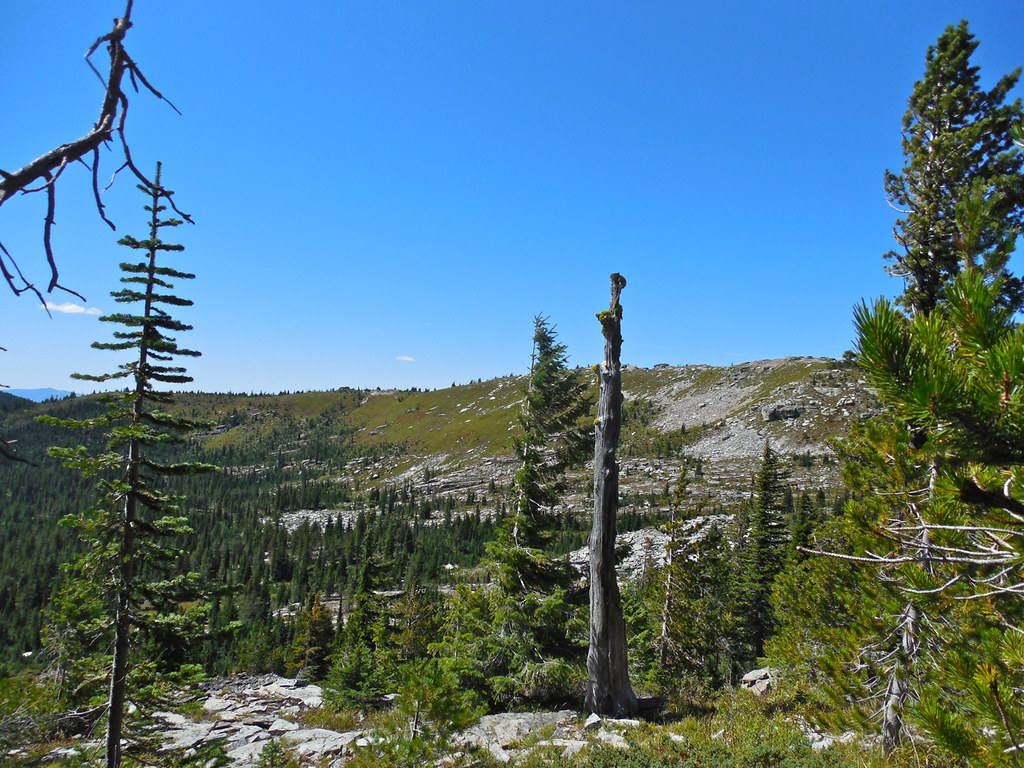
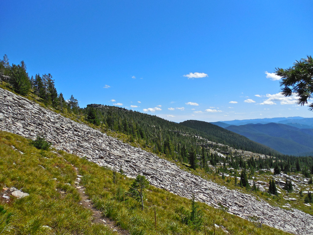
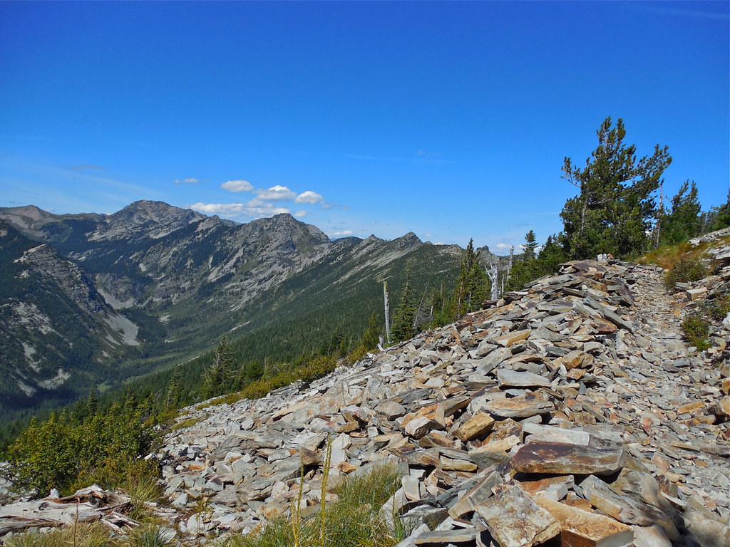
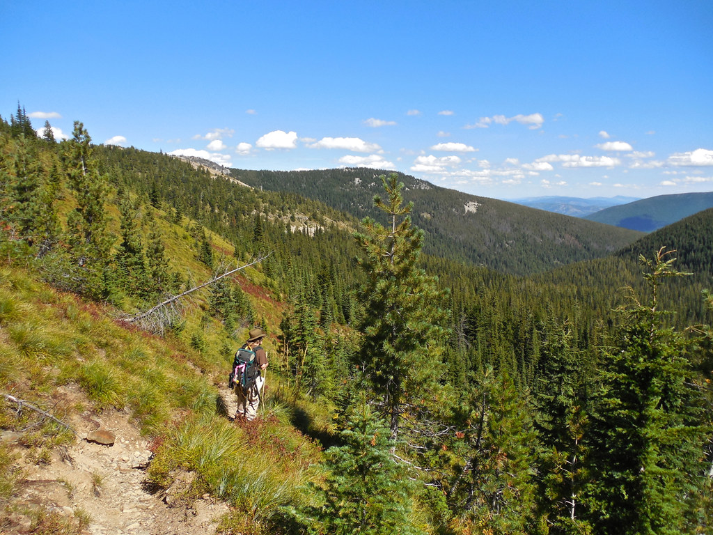
From Trail 63 ~ Trail 360 at the Cabinet Divide, Cabinet Mountains Wilderness
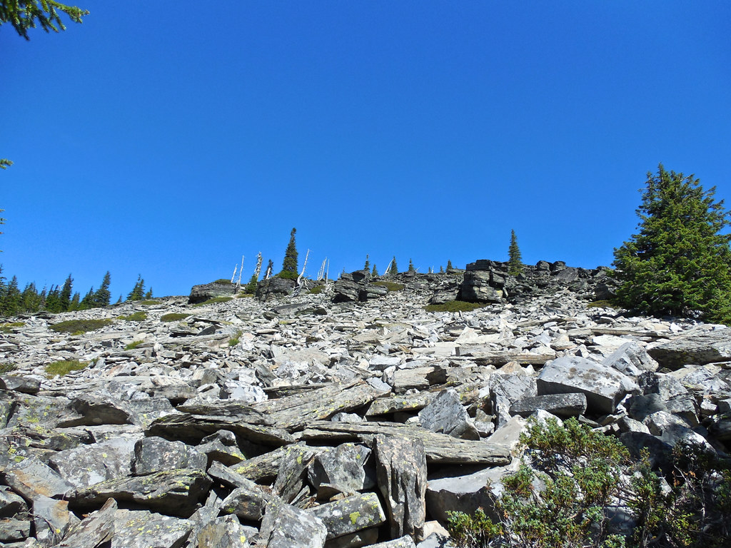
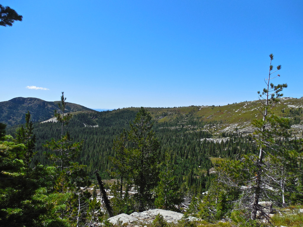
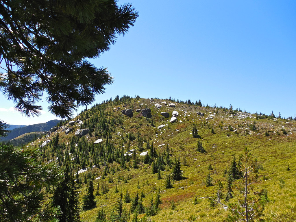
Trail 360 Cabinet Divide trail, Cabinet Mountains Wilderness
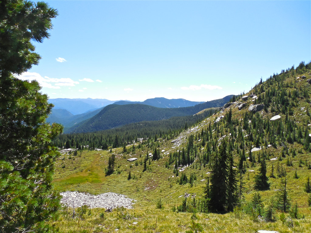
Trail 360 Cabinet Divide trail, Cabinet Mountains Wilderness
Trail 360 Cabinet Divide trail, Cabinet Mountains Wilderness
Trail 360 Cabinet Divide trail, Cabinet Mountains Wilderness
Trail 360 Cabinet Divide trail, Cabinet Mountains Wilderness
Trail 360 Cabinet Divide trail, Cabinet Mountains Wilderness
Trail 360 Cabinet Divide trail, Cabinet Mountains Wilderness
Trail 360 Cabinet Divide trail, Cabinet Mountains Wilderness
Baree Lake, Cabinet Mountains Wilderness
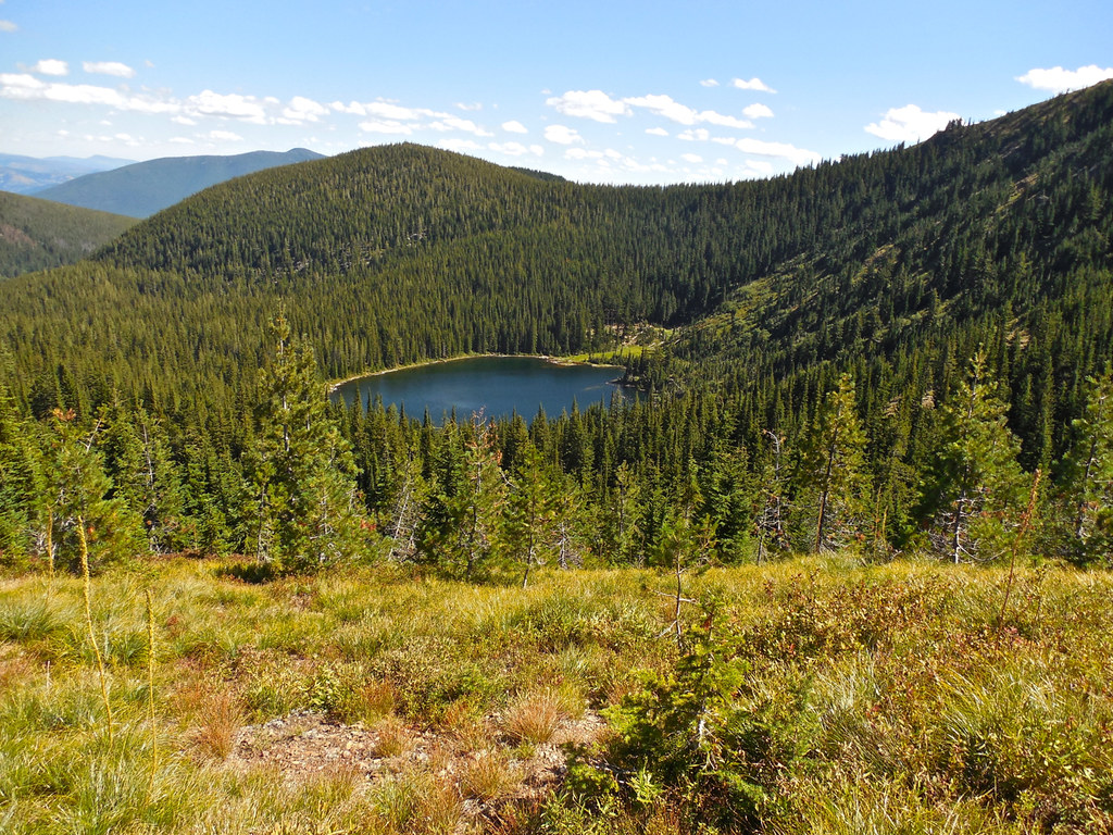
Baree Lake, Cabinet Mountains Wilderness
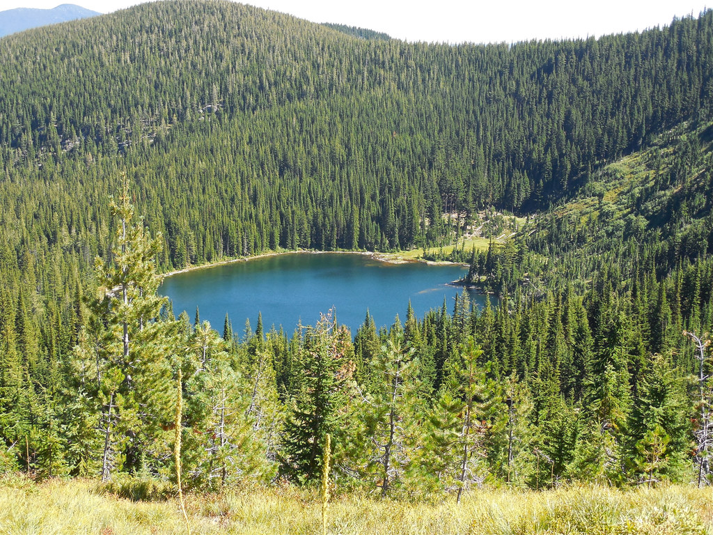
Baree Lake, Cabinet Mountains Wilderness
Trail 489 above Baree Lake, Cabinet Mountains Wilderness
Trail 489, Cabinet Mountains Wilderness
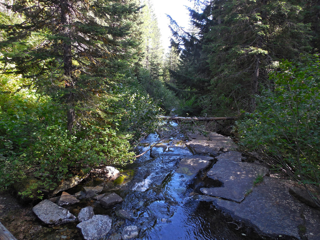
Trail 489, Cabinet Mountains Wilderness
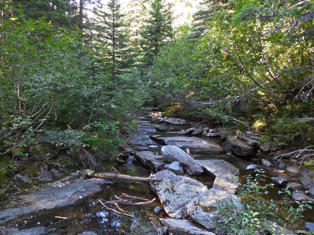
Baree Creek Trail 489, Cabinet Mountains Wilderness
Baree Creek Trail 489, Cabinet Mountains Wilderness
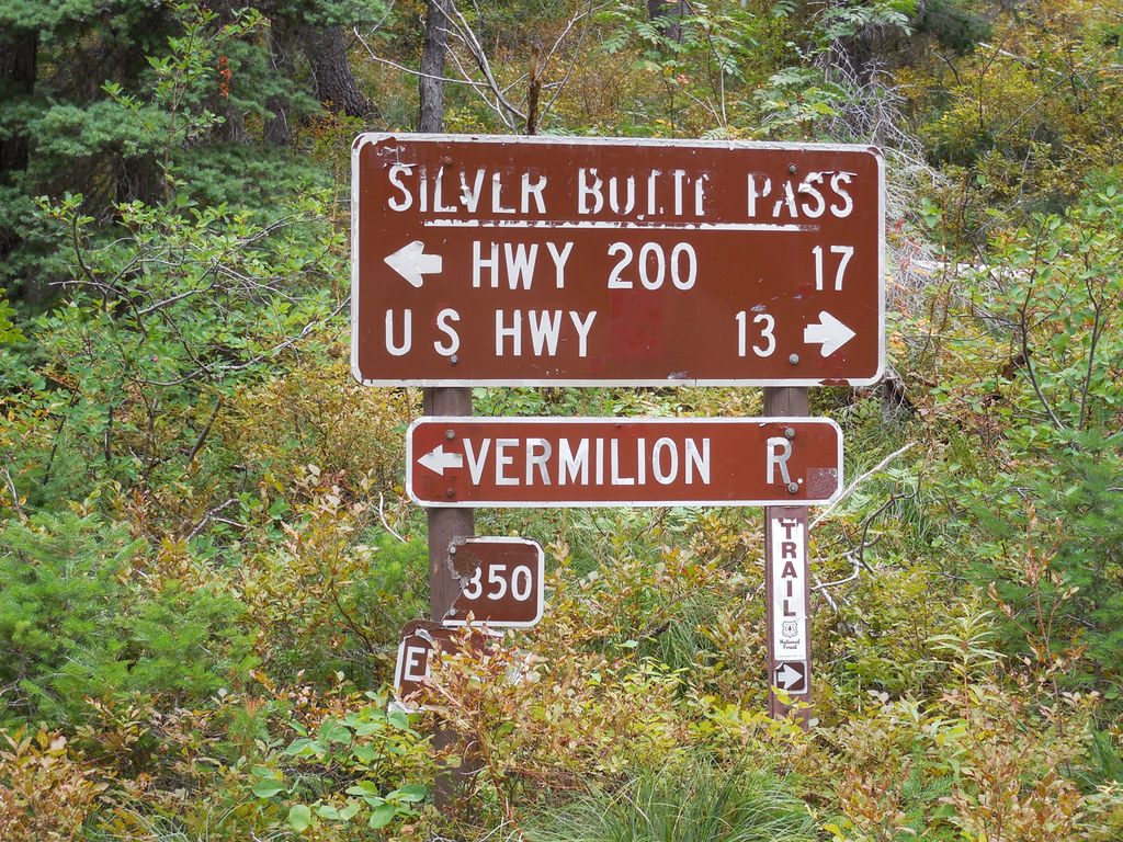
Road 148, Kootenai National Forest (There’s a sign near this one that reads: “No trailers or 2 wheel drive vehicles”)

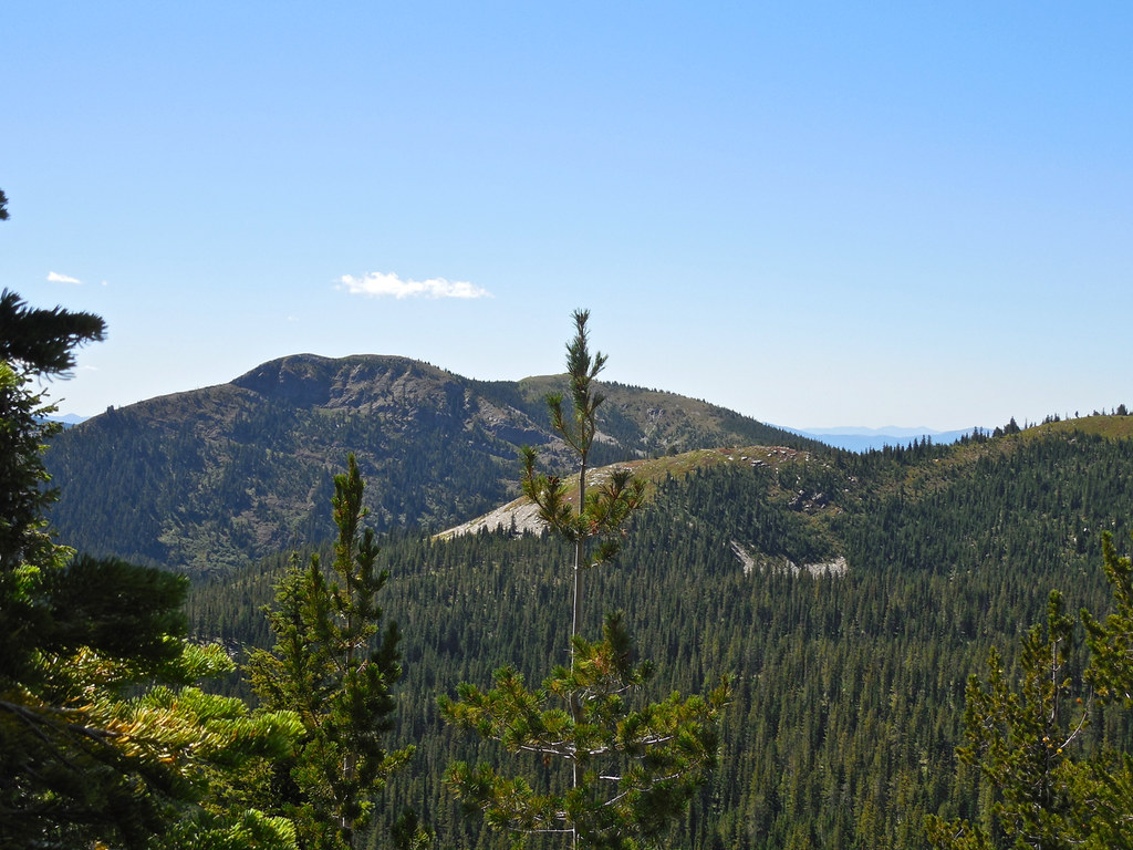
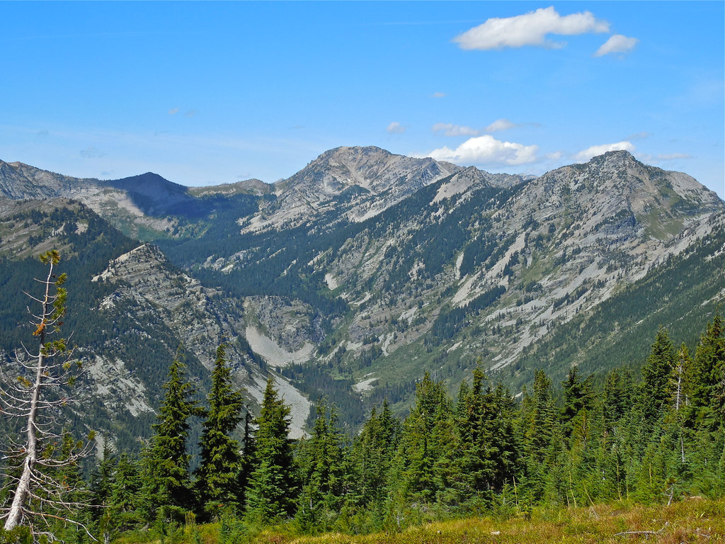
This is my favorite photo from the trip, taken from the Cabinet Divide trail 360. The three big peaks in the photo are, from right to left, Carney Peak, Flat Top Mountain, and Engle Peak. In a couple of weeks we plan a hike through a pass just to the right of Carney from the far side of the range and back a mile or so along the Cabinet Divide trail. (The trail through the pass and the high Cabinet Divide trail can be plainly seen on Google Earth.)
RSS feed for comments on this post. TrackBack URI

I enjoy the ‘poster’ board – and the waterfall is perfect.
LikeLike
Comment by Lynn Millar — September 9, 2014 @ 8:28 pm
From what I saw on those trails, folks are observing the reminders on the poster board. No trash, trail in pretty good shape, etc. Of course, there are very few who hike that loop.
LikeLike
Comment by montucky — September 9, 2014 @ 8:34 pm
Stunning and great information for my next trip. Luckily, there were few fires this year. The lightning fires in Thompson River were right around my house and my favorite places to hike. Did you camp over night or hike all the way through? Did you see anyone else? I am glad you can get out and do the longer hikes again.
LikeLike
Comment by David — September 9, 2014 @ 9:12 pm
I was thinking about you when those fires were going on. Luckily, the one closest to you was not very severe.
We hiked that all in one day. A night or two on the divide though would be wonderful! We saw no one at all on the whole hike, even on the access road. We drove up through Vermilion and up through Silver Butte Pass (a very rock road).
This turned out to be a milestone day for my new titanium knee. It held up perfectly and now I know I can hike anywhere I want again. What a relief!
LikeLike
Comment by montucky — September 9, 2014 @ 9:39 pm
Good to hear that your knee is holding up well. That’s quite a long hike! I was looking for all those bears the signs warmed about. Seeing those signs would be enough to make me turn around.
LikeLike
Comment by wordsfromanneli — September 9, 2014 @ 10:10 pm
I was very happy with the way the knee performed. A mixture of relief and joy.
We saw no sign of bears on any of the trails. The concern of course is for Grizzlies since that area is habitat for them. I was a little surprised that we didn’t see any bear activity because there was an abundance of ripe berries at the higher elevations.
LikeLike
Comment by montucky — September 9, 2014 @ 10:25 pm
Wow, how stunning! The scale and beauty of those mountains never cease to impress me. That sounds like a real, full-day hike, and I’m glad you have finally achieved your goal! Well done. Thanks for sharing these photos!
LikeLike
Comment by Jo Woolf — September 10, 2014 @ 2:19 am
Even after all of the years I still feel the same way about these mountains, Jo. It’s a privilege to be able to travel through them and share some of their secrets.
LikeLiked by 1 person
Comment by montucky — September 10, 2014 @ 8:16 am
Looks absolutely wonderful Terry, I can’t wait to go one day
LikeLike
Comment by Mike Howe — September 10, 2014 @ 3:32 am
I know you would enjoy the mountains, Mike.
LikeLike
Comment by montucky — September 10, 2014 @ 8:16 am
Wonderful series of images, Terry.
Thanks for sharing your hike. It’s almost as good as walking along side of you.
Surprising to me how much rock is on the hillsides. So very different to our mountainous areas.
LikeLike
Comment by Vicki — September 10, 2014 @ 4:06 am
It’s easy to see why these are labeled “the Rocky Mountains”, isn’t it. The solidity of their rock content though makes the plant ecology very fragile. The actual soil is very thin and prone to erosion in places where it is disturbed.
LikeLike
Comment by montucky — September 10, 2014 @ 8:18 am
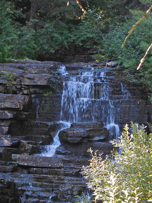
Mount Washington is the highest peak in New England at 6,289 feet, so I can imagine what this hike was like. It’s a little cooler and windier up there! Hiking over what looks like loose stone can’t be much fun but I’d do it for views like that. The waterfall alone would make it worth while.
LikeLike
Comment by New Hampshire Garden Solutions — September 10, 2014 @ 4:41 am
Yes, it’s always cooler on the mountain tops and high ridges and there is almost always a wind. It takes a lot of exertion to visit wilderness places but that’s a very small price to pay for the scenes and the feeling that you get there. I know you would have loved that trip!
LikeLike
Comment by montucky — September 10, 2014 @ 8:21 am
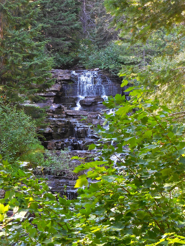
Whew! I feel like I just went on that hike with you! Can you hear me huffing and puffing? 😉 My favorite picture is of the waterfall and I liked the bulletin board with the ‘bear country warnings.’ Too bad you didn’t see one.
LikeLike
Comment by Mama's Empty Nest — September 10, 2014 @ 6:55 am
Yes, lots of huffing and puffing. I kid my hiking companion by telling her that I don’t like to have her go ahead of me up those trails because she uses up all of the air before I get there. The way the trail wound down through rather thick forest hid the waterfall until we had gone past it. My companion discovered it before I di or we might have missed it entirely.
LikeLiked by 1 person
Comment by montucky — September 10, 2014 @ 8:24 am
Amazing photos of stark beauty; what a hike! It was probably hard to keep going when you saw such wonderful sights. Know you are careful out there; the mom in me just can’t help but mention that! Thanks
LikeLike
Comment by Beth — September 10, 2014 @ 7:41 am
The scenery gives you a good excuse to hike slowly, and I do. It’s the best way to enjoy the wilderness. And yes, prudence is a virtue when in the back country where you might be days from help if you get into a predicament. It’s still worth the risk though!
LikeLike
Comment by montucky — September 10, 2014 @ 8:27 am
What a gorgeous series, Terry. Of course it’s impossible to chose “a favorite”, but I’m especially taken with the waterfalls, the images of that slender path snaking along through the wilderness, and some of the vistas across to the larger peaks. And oh, my — when I saw that it was a good, long day’s worth of hiking, I wondered. I’m glad to know you were happy and healthy all the way through. No wonder you’re planning the next hike.
LikeLike
Comment by shoreacres — September 10, 2014 @ 8:14 am
I’m glad that you enjoyed seeing the photos of the trip. That’s some of the country that I love the most. It’s worth any amount of effort to me to be able to go on trips like that. A crude calculation tells me that since January the re-hab program for my knee has taken close to 800 hours of exercise and walking. It was worth every second of that to be able to again hike through the high country in the wilderness. That’s natural beauty that few people are ever able to see in person and simply the feeling of being there is indescribable.
LikeLike
Comment by montucky — September 10, 2014 @ 8:36 am
What a wonderful hike…The photos were terrific. This is something I would like to try.
LikeLike
Comment by Charlie@Seattle Trekker — September 10, 2014 @ 2:20 pm
I hope you get a chance to hike in the wilderness. I know you’d be hooked on it after the first try!
LikeLike
Comment by montucky — September 10, 2014 @ 9:19 pm
Are there bluer skies than in Montana? I don’t think so.
LikeLike
Comment by jomegat — September 10, 2014 @ 4:13 pm
In many of the mountain areas in western Montana the air is very pure. There just isn’t much around to pollute it. It seems that the higher up you get, the bluer the sky too.
LikeLike
Comment by montucky — September 10, 2014 @ 9:22 pm
You had 10 hours of extreme beauty as far as the eye could see. I love the pretty little lake and the falls.
LikeLike
Comment by Candace — September 10, 2014 @ 6:53 pm
It’s not hard to put up with a full day of hiking through that kind of country! It does wonders for your soul!
LikeLike
Comment by montucky — September 10, 2014 @ 9:26 pm
Hi Montucky, Very beautiful area you live in. I sure do like the views you show from the trails. The lake and the stream look refreshingly cool. Have a wonderful day tomorrow and enjoy your forest and trails.
LikeLike
Comment by wildlifewatcher — September 10, 2014 @ 10:43 pm
Thanks wildlifewatcher. I’m glad that you like the views! I hope you have a wonderful day tomorrow too!
LikeLike
Comment by montucky — September 10, 2014 @ 10:55 pm
that looks like a wonderful and long hike
i enjoyed all the peaks of the trail in your photos – a bit like invitations
thank you for letting me know what the wee animal is: Golden-mantled Ground Squirrel, I had not gotten around to looking it up, such beautiful markings and colors.
thank you for sharing your hike with us.
LikeLike
Comment by Tammie — September 11, 2014 @ 4:25 am
Those peaks strike me the same way. Each time I enter the Cabinet Wilderness I leave with the same feeling, as though I had been invited back again. This was my 6th hike there and I have four more planned yet this year.
LikeLike
Comment by montucky — September 11, 2014 @ 9:19 pm
Fantastic ! … I´m completely falling in love with the state of Montana … // Maria 🙂
LikeLike
Comment by mariayarri — September 11, 2014 @ 6:10 pm
It is not hard to fall in love with these mountains, Maria! And I never tire of being in them.
LikeLike
Comment by montucky — September 11, 2014 @ 9:23 pm
What a wonderful set of gorgeous photos. Trail 63 seem to be difficult to pass. Baree Lake photo I studied for a long time.
LikeLike
Comment by Sartenada — September 12, 2014 @ 12:27 am
Thanks Matti! That is a very beautiful area and it is a privilege to be able to spend time there and see the wilderness at close range.
LikeLike
Comment by montucky — September 12, 2014 @ 9:09 pm
I guess your rebuilt knee is serving you well, Terry…. Such beautiful images…making me green with envy. 🙂
LikeLike
Comment by seekraz — September 12, 2014 @ 7:22 am
Yes, I have been very pleased with the results of the new knee. I can now do nearly everything that I have always done.
I know you would love that area, Scott. It has wilderness protection and represents the original wild country of northwest Montana. Pretty nice to be able to hike all day without seeing another person!
LikeLike
Comment by montucky — September 12, 2014 @ 9:12 pm
I’m very happy for you, Terry, that your knee has turned-out so well…I’ve had knee issues, too, over the years, and know the near misery that comes with not being able to do those physical things that we so love to do. And yes, I’m sure I would love your Cabinet Mountain wilderness area, as well…I adore that kind of beautiful solitude.
LikeLike
Comment by seekraz — September 13, 2014 @ 9:04 am
What gorgeous images and amazing LAND! That seems like quite a hike, too…. 🙂
LikeLike
Comment by FeyGirl — September 12, 2014 @ 11:46 am
It really is an amazing place. I visited there last year for the first time and now have completed 6 hikes into the wilderness area. It keeps inviting me back!
It was quite a hike and I needed to do a rather strenuous one to find out what my capability is now. I was overjoyed at the results!
LikeLike
Comment by montucky — September 12, 2014 @ 9:15 pm
Hello Terry and what an amazing trip and country! Truly beautiful although that doesn’t begin to do it justice. The waterfall was a pretty subject but I am with you on that panorama view of that basin. I picked that as my favorite in the earlier set before I got to the bottom and saw it was yours. Glad you are well and from the looks of things the fires must be out or all but out and providing that great “Big Sky” view. Take care – Ron p.s.watch your mailbox this week
LikeLike
Comment by Ron Mangels — September 21, 2014 @ 4:03 pm
Hi Ron,
Yes, the rains pretty well took care of the fires and the skies have been fairly clear with just a few days where the smoke from Idaho and Washington has drifted in here. This trip was beautiful but pretty demanding. Well worth it though! I have another trip into an area very close to it the first part of October.
LikeLike
Comment by montucky — September 21, 2014 @ 10:26 pm
… [Trackback]
[…] Read More here: montucky.wordpress.com/2014/09/09/bear-baree-lake-loop-cabinet-mountains-wilderness/ […]
LikeLike
Trackback by My Homepage — October 13, 2014 @ 11:50 pm
Hi there…I’m not sure that you’re still responding to this thread, but thought it was worth a try. I’m from Seattle and I’m looking for my next amazing backpacking adventure. Each Labor Day for 21 years now, I do a 4-7 day trip somewhere…never have I repeated the same trip. I came across the Cabinet Mtns and wonder if you have a recommendation for a 30-40 mile loop trip. I would likely be solo or with only one other person, and I travel light. For an idea of skill level…I hiked the Wonderland Trail around Mt Rainier solo last year in 6 days (93 miles). I’ve begun to research the Cabinets and they sound perfect for how I like to hike. I leave minimal impact and truly appreciate getting up high and away from the crowds.
Anyway…loved your pics and it inspired me to see if you have information on these beautiful mountains.
Thanks,
Jay
LikeLiked by 1 person
Comment by Anonymous — July 12, 2019 @ 11:45 am
Hello Jay!
I think you would love the Cabinet Mountain Wilderness! I’ve only done one day hikes there myself, so I can’t give you any good ideas about a longer loop trip, but if you contact someone at the Cabinet Ranger District you should be able to get the information you need. I’ve found them to be very helpful every time I’ve contacted them. Here’s a link: https://www.visitmt.com/listings/general/national-forest/cabinet-ranger-district.html. Keep in mind that’s potential Grizzly habitat although I’ve never encountered one there.
Happy hiking!
LikeLike
Comment by montucky — July 14, 2019 @ 1:07 pm
Many hikers miss “Upper Bear Lake” which is on a side trail (to the left going up) off of the main Bear Lakes trail. It is about one half mile from the overlook of Middle Bear Lake. It is the prettiest of the Bear Lakes. Also, the best loop is either to Barre and out, or down Trail 63 to the junction of Iron Meadow, then out on level terrain. Iron Meadow is very well maintained!
LikeLike
Comment by Anonymous — February 25, 2024 @ 2:04 pm
Thanks for an update! I haven’t been on those trails in just about 10 years.
LikeLiked by 1 person
Comment by montucky — February 25, 2024 @ 2:54 pm